
IMAGES TAKEN NEAR TO
Wilton Rise, YORK, YO24 4BW
Introduction
This page details the photographs taken nearby to Wilton Rise, YO24 4BW by members of the Geograph project.
The Geograph project started in 2005 with the aim of publishing, organising and preserving representative images for every square kilometre of Great Britain, Ireland and the Isle of Man.

There are currently over 7.5m images from over14,400 individuals and you can help contribute to the project by visiting https://www.geograph.org.uk
Image Map
Images are licensed for reuse under creativecommons.org/licenses/by-sa/2.0
Notes
- Clicking on the map will re-center to the selected point.
- The higher the marker number, the further away the image location is from the centre of the postcode.
Image Listing (516 Images Found)
Images are licensed for reuse under creativecommons.org/licenses/by-sa/2.0
Image
Details
Distance
1
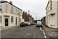
Wilton Rise
Part of an area of mainly railway workers' terraced housing dating from the second half of the 19th Century. This section was originally called Wilton Street; the name Wilton Rise was applied to the southern extension of semi-detached housing built in the 1930s, with the new name subsequently being applied to the whole road.
Image: © Ian Capper
Taken: 19 Jul 2017
0.01 miles
2
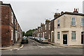
Upper St Paul's Terrace
Part of an area of mainly railway workers' terraced housing dating from the second half of the 19th Century.
Image: © Ian Capper
Taken: 19 Jul 2017
0.01 miles
3
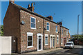
Wilton Rise
Part of an area of mainly railway workers' terraced housing dating from the second half of the 19th Century. This is a short final section ending with the Cinder Path footbridge over the railway, as seen in the background. Wilton Rise was originally called Wilton Street; the name Wilton Rise was applied to the southern extension of semi-detached housing built in the 1930s, with the new name subsequently being applied to the whole road.
Image: © Ian Capper
Taken: 17 Aug 2019
0.01 miles
4
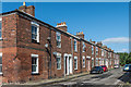
Upper St Paul's Terrace
Part of an area of mainly railway workers' terraced housing dating from the second half of the 19th Century.
Image: © Ian Capper
Taken: 17 Aug 2019
0.01 miles
5
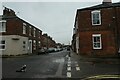
Cat on Wilton Rise
Looking across St. Paul's Terrace.
Image: © DS Pugh
Taken: 29 Oct 2022
0.01 miles
6
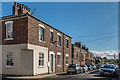
Wilton Rise
19th Century house on the corner of Wilton Rise and St Paul's Terrace in an area of mainly railway workers' terraced housing. Wilton Rise was originally called Wilton Street; the name Wilton Rise was applied to the southern extension of semi-detached housing built in the 1930s, seen in the background, with the new name subsequently being applied to the whole road.
Image: © Ian Capper
Taken: 20 Jul 2017
0.01 miles
7
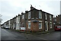
Railway Terrace and Wilton Rise
Looking towards the house on the corner of two streets from the bottom of the steps for Cinder Lane Bridge.
Image: © DS Pugh
Taken: 20 Dec 2021
0.02 miles
8
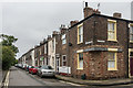
Railway Terrace
Part of an area of mainly railway workers' terraced housing dating from the second half of the 19th Century.
Image: © Ian Capper
Taken: 19 Jul 2017
0.02 miles
9
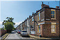
Railway Terrace
Part of an area of mainly railway workers' terraced housing dating from the second half of the 19th Century.
Image: © Ian Capper
Taken: 17 Aug 2019
0.03 miles
10
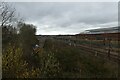
Snowplough in the sidings
A snowplough standing at the end of a siding viewed from a footbridge.
Image: © DS Pugh
Taken: 14 Mar 2021
0.03 miles