
IMAGES TAKEN NEAR TO
Spey Bank, YORK, YO24 2UZ
Introduction
This page details the photographs taken nearby to Spey Bank, YO24 2UZ by members of the Geograph project.
The Geograph project started in 2005 with the aim of publishing, organising and preserving representative images for every square kilometre of Great Britain, Ireland and the Isle of Man.

There are currently over 7.5m images from over14,400 individuals and you can help contribute to the project by visiting https://www.geograph.org.uk
Image Map
Images are licensed for reuse under creativecommons.org/licenses/by-sa/2.0
Notes
- Clicking on the map will re-center to the selected point.
- The higher the marker number, the further away the image location is from the centre of the postcode.
Image Listing (28 Images Found)
Images are licensed for reuse under creativecommons.org/licenses/by-sa/2.0
Image
Details
Distance
1
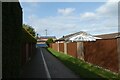
Lomond Ginnel
A cycle path leading from Moor Lane into Woodthorpe.
Image: © DS Pugh
Taken: 21 Mar 2021
0.08 miles
2
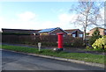
Bungalows, Woodthorpe, York
Showing position of Postbox No. YO24 448.
See Image] for postbox.
Image: © JThomas
Taken: 8 Feb 2020
0.09 miles
3
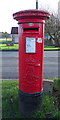
Edward VII postbox on Moor Lane, Woodthorpe, York
Image: © JThomas
Taken: 8 Feb 2020
0.09 miles
4
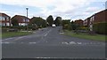
Eden Close
The junction of Eden Close on Acomb Park and Moor Lane.
Image: © Malcolm Temple
Taken: 11 Sep 2010
0.09 miles
5
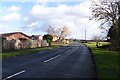
Letterbox on Moor Lane
On the southern side of Woodthorpe.
Image: © DS Pugh
Taken: 2 Feb 2014
0.09 miles
6
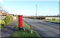
Moor Lane, Woodthorpe, York
Showing position of Postbox No. YO24 448.
See Image] for postbox.
Image: © JThomas
Taken: 8 Feb 2020
0.09 miles
8
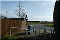
Moor Lane from Lomond Ginnel
Looking onto Moor Lane from a cycle path.
Image: © DS Pugh
Taken: 21 Mar 2021
0.10 miles
9
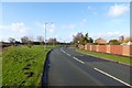
Moor Lane, Woodthorpe
Looking towards the A1237 on the southern edge of Woodthorpe.
Image: © DS Pugh
Taken: 2 Feb 2014
0.11 miles
10
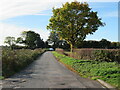
Old stretch of road
This little used stretch of road was once part of the Moor Lane route, but with housing development nearby [off photo to the right] the road was re-routed to avoid this short section which still has the look of a country lane.
Image: © Gordon Hatton
Taken: 28 Oct 2022
0.13 miles