IMAGES TAKEN NEAR TO
Farmlands Road, YORK, YO24 2UA
Introduction
This page details the photographs taken nearby to Farmlands Road, YO24 2UA by members of the Geograph project.
The Geograph project started in 2005 with the aim of publishing, organising and preserving representative images for every square kilometre of Great Britain, Ireland and the Isle of Man.

There are currently over 7.5m images from over14,400 individuals and you can help contribute to the project by visiting https://www.geograph.org.uk
Image Map (59 Images)
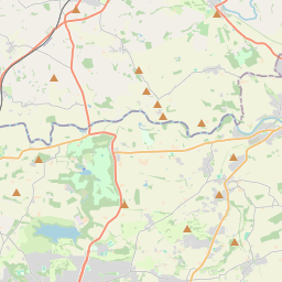

Leaflet Map data © OpenStreetMap
Images are licensed for reuse under creativecommons.org/licenses/by-sa/2.0
Notes
- Clicking on the map will re-center to the selected point.
- The higher the marker number, the further away the image location is from the centre of the postcode.
Image Listing (59 Images Found)
Images are licensed for reuse under creativecommons.org/licenses/by-sa/2.0
Image
Details
Distance
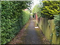
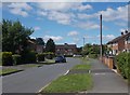
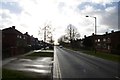
2
Farmlands Road, York
Leading off Chaloners Road, York.
Image: © Chris Heaton
Taken: 9 Jul 2022
0.02 miles
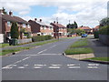
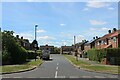
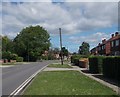
5
Chaloner's Road - viewed from West Thorpe
Image: © Betty Longbottom
Taken: 7 Jun 2017
0.04 miles
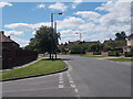
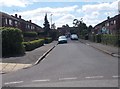
8
Chaloner's Road - viewed from West Thorpe
Image: © Betty Longbottom
Taken: 7 Jun 2017
0.05 miles
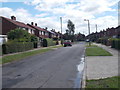
10
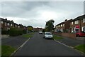
Wains Road
Looking along Wains Road towards the junction with Highmoor Road.
Image: © DS Pugh
Taken: 6 Aug 2021
0.08 miles