IMAGES TAKEN NEAR TO
Foxton, YORK, YO24 2SP
Introduction
This page details the photographs taken nearby to Foxton, YO24 2SP by members of the Geograph project.
The Geograph project started in 2005 with the aim of publishing, organising and preserving representative images for every square kilometre of Great Britain, Ireland and the Isle of Man.

There are currently over 7.5m images from over14,400 individuals and you can help contribute to the project by visiting https://www.geograph.org.uk
Image Map
Images are licensed for reuse under creativecommons.org/licenses/by-sa/2.0
Notes
- Clicking on the map will re-center to the selected point.
- The higher the marker number, the further away the image location is from the centre of the postcode.
Image Listing (19 Images Found)
Images are licensed for reuse under creativecommons.org/licenses/by-sa/2.0
Image
Details
Distance
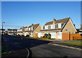
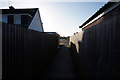
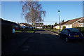
3
Ashbourne Way
Looking along Ashbourne Way near Foxton.
Image: © DS Pugh
Taken: 21 Mar 2021
0.04 miles
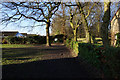
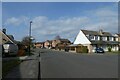
6
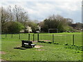
Foxwood Park
Small open area of grassland set amongst the housing estates on the SW side of York.
Image: © Gordon Hatton
Taken: 9 Apr 2022
0.09 miles