
IMAGES TAKEN NEAR TO
Thornhill, WHITBY, YO22 5NW
Introduction
This page details the photographs taken nearby to Thornhill, YO22 5NW by members of the Geograph project.
The Geograph project started in 2005 with the aim of publishing, organising and preserving representative images for every square kilometre of Great Britain, Ireland and the Isle of Man.

There are currently over 7.5m images from over14,400 individuals and you can help contribute to the project by visiting https://www.geograph.org.uk
Image Map
Images are licensed for reuse under creativecommons.org/licenses/by-sa/2.0
Notes
- Clicking on the map will re-center to the selected point.
- The higher the marker number, the further away the image location is from the centre of the postcode.
Image Listing (16 Images Found)
Images are licensed for reuse under creativecommons.org/licenses/by-sa/2.0
Image
Details
Distance
1
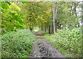
Old railway towards Goathland
This bridleway is the former (1836-1865) route of the railway towards Goathland.
Image: © Graham Horn
Taken: 20 Sep 2011
0.05 miles
2
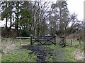
Old Whitby and Pickering original railway line near Goathland
This is the original track of the Whitby and Pickering horse-drawn railway south of Goathland. It was replaced in 1865 by the present line of the North Yorkshire Moors Railway (the deviation is about 200 yards to the right). The new line was an improvement in terms of more gradual gradients, and allowed steam power to be used. The original track is now a very pleasant walk. Here it is seen near Thornhill Farm.
Image: © John Martin
Taken: 10 Mar 2007
0.07 miles
3
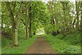
Railway Trackbed
The trackbed of the original Whitby to Pickering Railway is now a splendid footpath between Moorgates and Goathland. The track was made redundant in 1865 when the present line was opened, thus avoiding a severe incline at Esk Valley which required trains to be cable hauled.
Image: © K A
Taken: 6 May 2011
0.12 miles
4
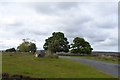
Eggs for sale at Thornhill Farm
A sign and a box for eggs at the entrance to this farm
Image: © David Smith
Taken: 14 Jun 2015
0.15 miles
5
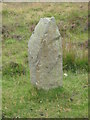
Old Wayside Cross
Goathland Road Marker 1, a Waymarker Stone in the form of a standing stone. Set on the south side of an open moorland road from St Mary's church to the A169 via Moorgates in Goathland parish. Grade II Listed https://historicengland.org.uk/listing/the-list/list-entry/1174199.
Milestone Society National ID: YNSC_GOA08a
Image: © Mike Rayner
Taken: 30 Jul 2020
0.15 miles
6
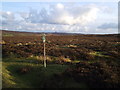
Start of bridleway
Taken from the road into Goathland looking towards Fylingdales just visible on the horizon.
Image: © Tim
Taken: 19 Feb 2006
0.19 miles
7
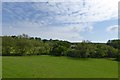
Field by the Eller Beck
Seen from the North Yorkshire Moors Railway, which runs on a slight embankment beside the beck
Image: © David Smith
Taken: 16 Jun 2015
0.20 miles
9
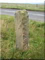
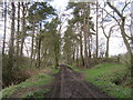
Old Wayside Cross
Goathland Road Marker 2, a Waymarker Stone in the form of a standing stone. Set on the south side of an open moorland road from St Mary's church to the A169 via Moorgates in Goathland parish. Grade II Listed https://historicengland.org.uk/listing/the-list/list-entry/1174199.
Milestone Society National ID: YNSC_GOA08b
Image: © Mike Rayner
Taken: 30 Jul 2020
0.20 miles
10
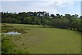
A marshy pool beside the railway south of Goathland
Image: © David Smith
Taken: 16 Jun 2015
0.21 miles