
IMAGES TAKEN NEAR TO
Orchard Road, WHITBY, YO22 5BY
Introduction
This page details the photographs taken nearby to Orchard Road, YO22 5BY by members of the Geograph project.
The Geograph project started in 2005 with the aim of publishing, organising and preserving representative images for every square kilometre of Great Britain, Ireland and the Isle of Man.

There are currently over 7.5m images from over14,400 individuals and you can help contribute to the project by visiting https://www.geograph.org.uk
Image Map
Images are licensed for reuse under creativecommons.org/licenses/by-sa/2.0
Notes
- Clicking on the map will re-center to the selected point.
- The higher the marker number, the further away the image location is from the centre of the postcode.
Image Listing (36 Images Found)
Images are licensed for reuse under creativecommons.org/licenses/by-sa/2.0
Image
Details
Distance
1
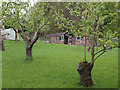
Small orchard near Iburndale Beck
Only two or three rows of trees.
Just inside the easting.
Image: © Stephen McCulloch
Taken: 16 May 2008
0.04 miles
2

Lowdale Lane, Sleights
Viewed from the junction with Birch Avenue.
Image: © Stephen Craven
Taken: 2 Sep 2024
0.07 miles
4

The bottom of Lowdale Lane, Sleights
Viewed from below the junction with Bank Close.
Image: © Stephen Craven
Taken: 2 Sep 2024
0.12 miles
5

Beckholme, Sleights
A modern housing development off Lowdale Lane.
Image: © Stephen Craven
Taken: 2 Sep 2024
0.14 miles
6
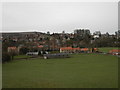
Sleights Cricket Club
Sports ground and cricket club viewed from Echo Hill.
Image: © Darren Haddock
Taken: 20 Apr 2006
0.16 miles
7
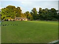
Bowling green at the end of Beckholme, Sleights
There was a match in progress on this fine summer evening. The players were happy for me to take a photo of the green but did not wish to be in the photo themselves.
Image: © Stephen Craven
Taken: 2 Sep 2024
0.16 miles
8
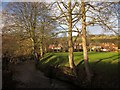
Iburndale Beck
Taken a few metres from Image], from the footbridge carrying the Esk Valley Walk over the beck, with the cricket ground on the right.
Image: © Derek Harper
Taken: 30 Dec 2012
0.16 miles
9

Footbridge at the bottom of Lowdale Lane
The bridge crosses Iburndale Beck. The beck marks the boundary of the North York Moors National Park (on the far side).
Image: © Stephen Craven
Taken: 2 Sep 2024
0.16 miles
10

Iburndale Beck
A minor tributary of the Esk.
Image: © Stephen Craven
Taken: 2 Sep 2024
0.17 miles