
IMAGES TAKEN NEAR TO
Chapel Street, WHITBY, YO22 4SQ
Introduction
This page details the photographs taken nearby to Chapel Street, YO22 4SQ by members of the Geograph project.
The Geograph project started in 2005 with the aim of publishing, organising and preserving representative images for every square kilometre of Great Britain, Ireland and the Isle of Man.

There are currently over 7.5m images from over14,400 individuals and you can help contribute to the project by visiting https://www.geograph.org.uk
Image Map
Images are licensed for reuse under creativecommons.org/licenses/by-sa/2.0
Notes
- Clicking on the map will re-center to the selected point.
- The higher the marker number, the further away the image location is from the centre of the postcode.
Image Listing (681 Images Found)
Images are licensed for reuse under creativecommons.org/licenses/by-sa/2.0
Image
Details
Distance
1
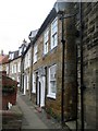
Ebor Cottage & West Lea, Chapel Street
A grade II listed house, now 2 dwellings, dated early-mid C18. Ebor Cottage to left, West Lea to right.
LBS No: 327692
Image: © Mike Kirby
Taken: 7 Jul 2010
0.00 miles
2
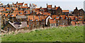
Rooftops in Baytown
The red pantiles are very common in this area. The intimate nature of the buildings is reinforced by the narrow streets, many just a few feet wide.
Image: © Peter Church
Taken: 23 Apr 2006
0.00 miles

4
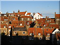
Robin Hood's Bay roofscape 2
Another view from Fisher Head. Practically every building is stone built under a clay pantile roof.
Image: © Christopher Hall
Taken: 1 Jan 2013
0.01 miles
5
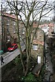
King's Beck
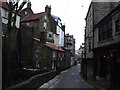
Squashed in by the tall cottages of Robin Hood's Bay.
Image: © Mick Garratt
Taken: 15 Feb 2007
0.01 miles
7
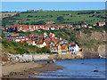
Baytown from the Beach
The tide is still quite high, so the beach is accessed via the top of the sea wall.
This view reveals a tale of two towns, the intimate clusters of multi-storey cottages running down the hill to the beach, and the more expansive settlement at the top of the hill.
Image: © Peter Church
Taken: 30 Sep 2006
0.01 miles
8

King Street
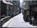
Looking up King Street from close to the slipway.
Image: © DS Pugh
Taken: 10 Aug 2008
0.01 miles
10
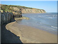
Beach at Robin Hood's Bay
This image was taken as the tide was coming in. The sandy beach would soon be submerged by the sea.
Image: © Malc McDonald
Taken: 28 Apr 2021
0.01 miles