IMAGES TAKEN NEAR TO
Kildale, WHITBY, YO21 2RN
Introduction
This page details the photographs taken nearby to YO21 2RN by members of the Geograph project.
The Geograph project started in 2005 with the aim of publishing, organising and preserving representative images for every square kilometre of Great Britain, Ireland and the Isle of Man.

There are currently over 7.5m images from over14,400 individuals and you can help contribute to the project by visiting https://www.geograph.org.uk
Image Map (Loading...)


Getting Data...Please wait
Leaflet Map data © OpenStreetMap
Images are licensed for reuse under creativecommons.org/licenses/by-sa/2.0
Notes
- Clicking on the map will re-center to the selected point.
- The higher the marker number, the further away the image location is from the centre of the postcode.
Image Listing (16 Images Found)
Images are licensed for reuse under creativecommons.org/licenses/by-sa/2.0
Image
Details
Distance
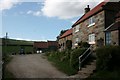
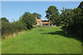
1
Park Farm
From the Public Footpath to Low Farm.
Image: © Mick Garratt
Taken: 18 May 2007
0.01 miles
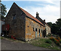
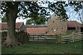
2
Park Farm
With a few swifts flying into the picture I hadn't noticed.
Image: © Mick Garratt
Taken: 18 May 2007
0.01 miles
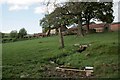
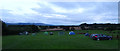
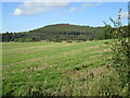
6
Park Farm, Kildale
One of the camping fields at Park Farm.
Image: © habiloid
Taken: 23 Aug 2015
0.02 miles
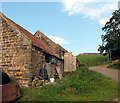
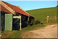
10
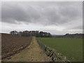
The footpath to the camping barn
Along the Cleveland Way.
Image: © steven ruffles
Taken: 7 Mar 2015
0.13 miles