
IMAGES TAKEN NEAR TO
Sunny Brow, WHITBY, YO21 2HB
Introduction
This page details the photographs taken nearby to Sunny Brow, YO21 2HB by members of the Geograph project.
The Geograph project started in 2005 with the aim of publishing, organising and preserving representative images for every square kilometre of Great Britain, Ireland and the Isle of Man.

There are currently over 7.5m images from over14,400 individuals and you can help contribute to the project by visiting https://www.geograph.org.uk
Image Map
Images are licensed for reuse under creativecommons.org/licenses/by-sa/2.0
Notes
- Clicking on the map will re-center to the selected point.
- The higher the marker number, the further away the image location is from the centre of the postcode.
Image Listing (34 Images Found)
Images are licensed for reuse under creativecommons.org/licenses/by-sa/2.0
Image
Details
Distance
1
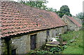
Barns at Castleton quarries
These may be farm buildings, or they may be associated with the former quarries on this side of the Esk Valley. The former seems more likely.
Image: © Graham Horn
Taken: 23 Sep 2011
0.01 miles
2
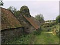
Bridleway and barns at Park Nook
Many of the barns around Esk Dale have been converted into housing in recent years. These ones have escaped that fate - so far.
Image: © Stephen McCulloch
Taken: 5 Oct 2007
0.02 miles
3
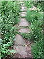
Stone trod near Park Nook
A short stretch of trod near Park Nook.
Image: © T Eyre
Taken: 7 Jul 2021
0.03 miles
4
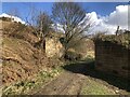
Abutments of former tramway incline bridge
The incline served silica quarries above Castleton, taking the stone to a crushing plant near the current day station on the Esk Valley line. The quarries were in operation until the mid 20th century and had two inclines reflecting the migration of the quarries as stone was worked out. The incline pictured was the second, build in 1919.
Image: © David Robinson
Taken: 2 Apr 2024
0.03 miles
6
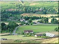
Castleton
With the cricket field making the most of the flat ground. The Esk Inn can be seen just over the river bridge with the railway behind that.
Image: © Mick Garratt
Taken: 19 Jul 2005
0.09 miles
8
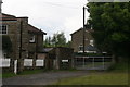
Track to Castleton Moor railway station
Image: © Adam Brookes
Taken: 11 Jun 2009
0.10 miles
9
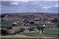
Castleton Station from across the valley in 1958
Taken by my late father, this is the view north over the valley towards the station. Note the lack of trees in this compared to the current view.
Image: © Tony Whelan (Deceased)
Taken: Unknown
0.10 miles
10
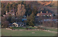
Castleton Moor station
Looking down on the railway station from the top of Castleton.
Image: © Colin Grice
Taken: 19 Feb 2012
0.10 miles