IMAGES TAKEN NEAR TO
Stonegate, WHITBY, YO21 2AB
Introduction
This page details the photographs taken nearby to Stonegate, YO21 2AB by members of the Geograph project.
The Geograph project started in 2005 with the aim of publishing, organising and preserving representative images for every square kilometre of Great Britain, Ireland and the Isle of Man.

There are currently over 7.5m images from over14,400 individuals and you can help contribute to the project by visiting https://www.geograph.org.uk
Image Map
Images are licensed for reuse under creativecommons.org/licenses/by-sa/2.0
Notes
- Clicking on the map will re-center to the selected point.
- The higher the marker number, the further away the image location is from the centre of the postcode.
Image Listing (10 Images Found)
Images are licensed for reuse under creativecommons.org/licenses/by-sa/2.0
Image
Details
Distance
1
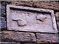
Old Milestone in Stonegate Mill Farm barn, Lealholm parish
Stone plaque by the UC road, in parish of Lealholm (Scarborough District), Stonegate, built into Stonegate Mill Farm barn wall, just below eaves, North side of road.
Inscription reads:-
WHITBY {hand->} (8?)M
6 {<-hand} CASTLETON
Surveyed
Milestone Society National ID: YN_XNZ7709
Image: © Milestone Society
Taken: Unknown
0.02 miles
3
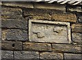
Very old waymarker
Set in the barn wall at Stonegate is this 18th Century-looking sign.
Hands point to Whitby at 5(?) Miles and Castleton at 6 Miles.
Edit: the barn has since been converted into a small holiday let but the stone is still preserved in-situ.
Image: © Colin Grice
Taken: 23 Jan 2006
0.06 miles
4
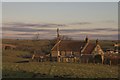
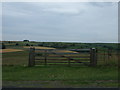
Cottage at Stonegate
Wilkes Farm in the background RH side.
Image: © Colin Grice
Taken: 29 Jan 2006
0.07 miles
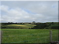
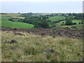
7
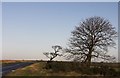
The road to Greenhouses from Stonegate
Wintry Sunshine shows off the bare trees.
Image: © Colin Grice
Taken: 11 Dec 2006
0.16 miles
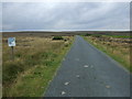
8
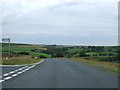
Road junction and bend near Stonegate
Heading north towards the A171.
Image: © JThomas
Taken: 26 Jul 2015
0.16 miles
10
Minor road towards Green Houses
Heading west.
Image: © JThomas
Taken: 26 Jul 2015
0.21 miles