
IMAGES TAKEN NEAR TO
South End Gardens, WHITBY, YO21 1JY
Introduction
This page details the photographs taken nearby to South End Gardens, YO21 1JY by members of the Geograph project.
The Geograph project started in 2005 with the aim of publishing, organising and preserving representative images for every square kilometre of Great Britain, Ireland and the Isle of Man.

There are currently over 7.5m images from over14,400 individuals and you can help contribute to the project by visiting https://www.geograph.org.uk
Image Map
Images are licensed for reuse under creativecommons.org/licenses/by-sa/2.0
Notes
- Clicking on the map will re-center to the selected point.
- The higher the marker number, the further away the image location is from the centre of the postcode.
Image Listing (171 Images Found)
Images are licensed for reuse under creativecommons.org/licenses/by-sa/2.0
Image
Details
Distance

2
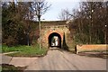
Tunnel under disused railway
This photograph shows a view of a tunnel underneath the (now disused) railway line which used to run between Scarborough (in the south) and Staithes (in the north). The section of track that lies to the right of the tunnel is now used as a walkway (see here: Image ); a flight of steps on the other side of the tunnel provides access to this. The picture was taken looking in an east-north-easterly direction towards Fishburn Park.
Image: © Philip Barker
Taken: 25 Mar 2010
0.01 miles
3
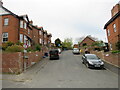
Southend Gardens, Whitby
Southend Gardens is a residential cul-de-sac on a steep gradient in Whitby.
Image: © Malc McDonald
Taken: 26 Apr 2021
0.01 miles
4
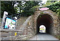
The Cinder Track bridge
Crossing Southend Gardens in Whitby.
Image: © Mat Fascione
Taken: 10 Aug 2018
0.01 miles
5

Whitby Sanitary Board marker on wall of Arundel House, Southend Gardens
WSB
1837
No.26
Not a boundary marker, most likely marking Stakesby Beck which is culverted here, and joins Arundel Beck here and continues as Bagdale Back.
Image: © J G Harston
Taken: Unknown
0.02 miles
6
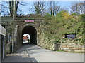
Cinder Track, Whitby
This arch used to pass beneath a railway line linking Scarborough with Whitby and beyond. The railway closed in stages between 1958 and 1965. The trackbed from Whitby to Scarborough now forms the route of the Cinder Track footpath. The path also forms part of the route of National Cycle Network route 1.
Image: © Malc McDonald
Taken: 26 Apr 2021
0.02 miles
7
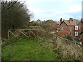
The end of the railway path at Whitby
There is an unfortunate gap in the route here. The old railway track seems to have been added to the grounds of a house, beyond which it has become a residential road (Kirkham Road).
Image: © Humphrey Bolton
Taken: 25 Dec 2012
0.02 miles
8
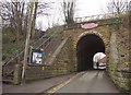
Bridge, Southend Gardens, Whitby
The steps lead up to the Cinder Track, the former railway to Scarborough. In my case, it took me to Robin Hood's Bay, through a drenching downpour.
Image: © Derek Harper
Taken: 31 Dec 2012
0.02 miles
9
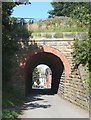
Railway Bridge, Stakesby Vale, Whitby
Now carrying National Cycle Route 1.
Image: © Humphrey Bolton
Taken: 30 Jul 2011
0.03 miles
10
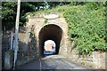
The Start (or end) of the Cinder Track at Whitby
The bridge near Southend Gardens in Whitby marks the beginning (or probably the end) of The Cinder Track, a multi-use path following the route of the old Scarborough & Whitby Railway.
Wikipedia https://en.wikipedia.org/wiki/Scarborough_and_Whitby_Railway
Image: © Jeff Buck
Taken: 30 Jun 2022
0.03 miles