
IMAGES TAKEN NEAR TO
New Road, YORK, YO19 6EZ
Introduction
This page details the photographs taken nearby to New Road, YO19 6EZ by members of the Geograph project.
The Geograph project started in 2005 with the aim of publishing, organising and preserving representative images for every square kilometre of Great Britain, Ireland and the Isle of Man.

There are currently over 7.5m images from over14,400 individuals and you can help contribute to the project by visiting https://www.geograph.org.uk
Image Map
Images are licensed for reuse under creativecommons.org/licenses/by-sa/2.0
Notes
- Clicking on the map will re-center to the selected point.
- The higher the marker number, the further away the image location is from the centre of the postcode.
Image Listing (27 Images Found)
Images are licensed for reuse under creativecommons.org/licenses/by-sa/2.0
Image
Details
Distance
1
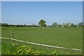
Field near Sheepwalk Farm
Looking across fields from New Road.
Image: © DS Pugh
Taken: 6 May 2018
0.05 miles
4
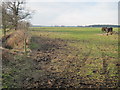
The Vale of York is not Hilly
From the New Road northeast of Sheepwalk Farm, gives you some idea of the flatness of the area.
Image: © Martin Dawes
Taken: 2 Mar 2010
0.08 miles
5
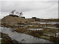
Not much remains
The North Selby Mine was part of the relatively short lived Selby coalfield. Plans for redeveleopment seem to have stalled and virtually all surface buildings have been demolished.
Image: © Jonathan Thacker
Taken: 30 Dec 2017
0.09 miles
6
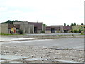
North Selby Mine
A few of the remaining buildings from this closed 'super pit'.
Image: © Chris Allen
Taken: 4 Aug 2013
0.09 miles
7
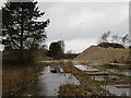
Returning to nature
The North Selby Mine was part of the relatively short lived Selby coalfield. Plans for redevelopment seem to have stalled and virtually all surface buildings have been demolished.
Image: © Jonathan Thacker
Taken: 30 Dec 2017
0.09 miles
8
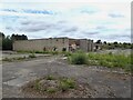
Derelict building on the coal mine site
Area untouched for years
Image: © David Brown
Taken: 14 Aug 2021
0.10 miles
9
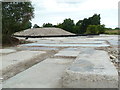
North Selby Mine
One of the six shaft accessed mines that were part of the Selby coalfield 'super pit'. The coal came up a drift at the seventh site at Gascoigne Wood. Several abandoned buildings still remain but the head gear has been demolished. I'm stood by a substantial machinery base and there is a large pile of rubble that might mark the location of a shaft that was operated by a conventional ground mounted winding engine.
Image: © Chris Allen
Taken: 4 Aug 2013
0.12 miles
10
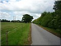
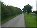
New Road near Sheepwalk Farm
Leading from the A19 to Warren House Farm.
Image: © DS Pugh
Taken: 31 May 2010
0.14 miles