
IMAGES TAKEN NEAR TO
Thorganby, YORK, YO19 6DQ
Introduction
This page details the photographs taken nearby to YO19 6DQ by members of the Geograph project.
The Geograph project started in 2005 with the aim of publishing, organising and preserving representative images for every square kilometre of Great Britain, Ireland and the Isle of Man.

There are currently over 7.5m images from over14,400 individuals and you can help contribute to the project by visiting https://www.geograph.org.uk
Image Map
Images are licensed for reuse under creativecommons.org/licenses/by-sa/2.0
Notes
- Clicking on the map will re-center to the selected point.
- The higher the marker number, the further away the image location is from the centre of the postcode.
Image Listing (11 Images Found)
Images are licensed for reuse under creativecommons.org/licenses/by-sa/2.0
Image
Details
Distance
1
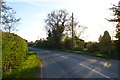
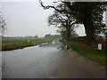
Road passing Gale Cottage
The road between Thorganby and Thorganby Gale.
Image: © DS Pugh
Taken: 4 May 2016
0.05 miles
3
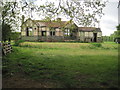
Thorganby railway station (site), Yorkshire
Opened in 1912 by the Derwent Valley Light Railway on the line from York (Layerthorpe) to Cliffe Common, this station closed to passengers in 1926 and completely in 1968.
View east across the former railway line towards the old station building, which was in need of some serious tlc when this image was taken.
Image: © Nigel Thompson
Taken: 19 May 2015
0.08 miles
4
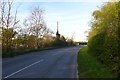
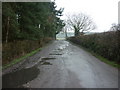
Road to Thorganby
Looking along the road leading to Thorganby near Gale Cottage.
Image: © DS Pugh
Taken: 4 May 2016
0.09 miles
5
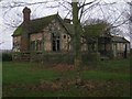
The remains of Thorganby station
A typical Derwent Valley Light Railway station now sadly in a very poor state of repair. A similar station was that at Wheldrake which is now at the Yorkshire Museum of Farming and which can just be seen in Image
Image: © Jonathan Thacker
Taken: 1 Jan 2014
0.09 miles
9
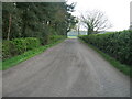
Lindum Turf
A side road off the Thorganby road. Much of the farmland in this area is used for growing lawn turf.
Image: © DS Pugh
Taken: 4 May 2016
0.15 miles
10
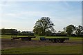
Harvesting turf
Fields of lawn turf being rolled and collected up for sale.
Image: © DS Pugh
Taken: 4 May 2016
0.19 miles