
IMAGES TAKEN NEAR TO
Murton, YORK, YO19 5XB
Introduction
This page details the photographs taken nearby to YO19 5XB by members of the Geograph project.
The Geograph project started in 2005 with the aim of publishing, organising and preserving representative images for every square kilometre of Great Britain, Ireland and the Isle of Man.

There are currently over 7.5m images from over14,400 individuals and you can help contribute to the project by visiting https://www.geograph.org.uk
Image Map
Images are licensed for reuse under creativecommons.org/licenses/by-sa/2.0
Notes
- Clicking on the map will re-center to the selected point.
- The higher the marker number, the further away the image location is from the centre of the postcode.
Image Listing (25 Images Found)
Images are licensed for reuse under creativecommons.org/licenses/by-sa/2.0
Image
Details
Distance
1
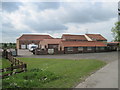
Murton Grange
Also has holiday cottages
Image: © Martin Dawes
Taken: 11 May 2011
0.01 miles
2
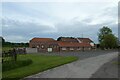
Murton Grange
Looking towards self catering accommodation on Bad Bargain Lane.
Image: © DS Pugh
Taken: 18 May 2022
0.01 miles
3
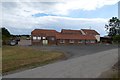
Murton Grange
Holiday cottages along Bad Bargain Lane.
Image: © DS Pugh
Taken: 28 Jul 2013
0.03 miles
4
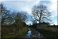
Towards Murton Grange
Looking along Bad Bargain Lane.
Image: © DS Pugh
Taken: 20 Dec 2020
0.06 miles
5
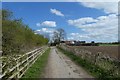
Approaching Murton Grange
Looking along Bad Bargain Lane towards a farm.
Image: © DS Pugh
Taken: 31 Mar 2019
0.07 miles
6

Fields beside Bad Bargain Lane
Looking across an arable field near Murton Grange.
Image: © DS Pugh
Taken: 6 Aug 2022
0.07 miles
7
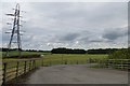
Bridleway to Stockton Lane
Leading to Cow Moor Farm from Bad Bargain Lane.
Image: © DS Pugh
Taken: 28 Jul 2013
0.07 miles
8
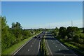
A64 from Bad Bargain Lane
Looking along the A64 towards Grimston Bar.
Image: © DS Pugh
Taken: 30 May 2021
0.08 miles
9
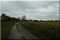
Bad Bargain Lane
Looking along Bad Bargain Lane towards Murton Grange.
Image: © DS Pugh
Taken: 14 Nov 2020
0.08 miles
10
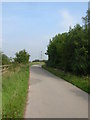
Bad Bargain Lane
Looking up as Bad Bargain Lane crosses above the A64. This former road in many sections now is very narrow and has been redesignated a bridleway.
Image: © DS Pugh
Taken: 17 Sep 2006
0.09 miles