IMAGES TAKEN NEAR TO
Crockey Hill, YORK, YO19 4SL
Introduction
This page details the photographs taken nearby to YO19 4SL by members of the Geograph project.
The Geograph project started in 2005 with the aim of publishing, organising and preserving representative images for every square kilometre of Great Britain, Ireland and the Isle of Man.

There are currently over 7.5m images from over14,400 individuals and you can help contribute to the project by visiting https://www.geograph.org.uk
Image Map
Images are licensed for reuse under creativecommons.org/licenses/by-sa/2.0
Notes
- Clicking on the map will re-center to the selected point.
- The higher the marker number, the further away the image location is from the centre of the postcode.
Image Listing (27 Images Found)
Images are licensed for reuse under creativecommons.org/licenses/by-sa/2.0
Image
Details
Distance
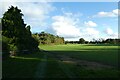
1
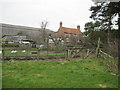
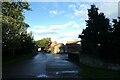
Tillmire Farm
A house at Tillmire Farm from the bridleway between Crockey Hill and Fulford.
Image: © DS Pugh
Taken: 18 Apr 2010
0.01 miles
4
Footpath at Tillmire Farm
Leading to Heslington Tillmire.
Image: © DS Pugh
Taken: 30 Oct 2021
0.04 miles
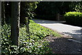
5
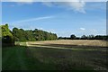
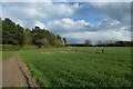
Footpath near Tillmire Farm
Looking along a footpath leading to the Tillmire.
Image: © DS Pugh
Taken: 12 Sep 2020
0.04 miles
6
Path near Tillmire Farm
Linking through to Heslington Tillmire.
Image: © DS Pugh
Taken: 11 May 2020
0.05 miles
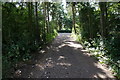
7
Path leading towards the Tillmire
Looking along the path leading onto the Tillmire.
Image: © DS Pugh
Taken: 11 Apr 2021
0.06 miles
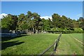
8
Tillmire Farm
Looking towards Tillmire Farm. A footpath leads to the right.
Image: © DS Pugh
Taken: 30 Oct 2021
0.06 miles