
IMAGES TAKEN NEAR TO
Rye Close, YO18 7UE
Introduction
This page details the photographs taken nearby to Rye Close, YO18 7UE by members of the Geograph project.
The Geograph project started in 2005 with the aim of publishing, organising and preserving representative images for every square kilometre of Great Britain, Ireland and the Isle of Man.

There are currently over 7.5m images from over14,400 individuals and you can help contribute to the project by visiting https://www.geograph.org.uk
Image Map
Images are licensed for reuse under creativecommons.org/licenses/by-sa/2.0
Notes
- Clicking on the map will re-center to the selected point.
- The higher the marker number, the further away the image location is from the centre of the postcode.
Image Listing (17 Images Found)
Images are licensed for reuse under creativecommons.org/licenses/by-sa/2.0
Image
Details
Distance
1
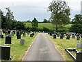
Pickering Cemetery on Whitby Road
New residential properties have recently sprung up on green belt land to the right of this picture.
Image: © Jonathan Clitheroe
Taken: 18 Jun 2021
0.11 miles
2

The A169 road to Whitby as it leaves Pickering
Image: © Phil Catterall
Taken: 19 Jun 2006
0.11 miles

6

Terraced houses on Whitby Road. Pickering
This view looking toward Pickering on the A169 Whitby Road
Image: © Martin Dawes
Taken: 2 Apr 2019
0.16 miles

8
Welcome to Pickering
Entering Pickering from the northeast on the A169.
Image: © Barbara Carr
Taken: 18 Jun 2013
0.19 miles
9
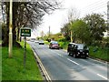
The A169 at Pickering
Sunday afternoon traffic entering Pickering from the Whitby direction.
Image: © Mary and Angus Hogg
Taken: 22 Apr 2012
0.22 miles
