
IMAGES TAKEN NEAR TO
Freers Yard, MALTON, YO17 9ET
Introduction
This page details the photographs taken nearby to Freers Yard, YO17 9ET by members of the Geograph project.
The Geograph project started in 2005 with the aim of publishing, organising and preserving representative images for every square kilometre of Great Britain, Ireland and the Isle of Man.

There are currently over 7.5m images from over14,400 individuals and you can help contribute to the project by visiting https://www.geograph.org.uk
Image Map
Images are licensed for reuse under creativecommons.org/licenses/by-sa/2.0
Notes
- Clicking on the map will re-center to the selected point.
- The higher the marker number, the further away the image location is from the centre of the postcode.
Image Listing (99 Images Found)
Images are licensed for reuse under creativecommons.org/licenses/by-sa/2.0
Image
Details
Distance
1
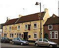
The Union, Norton
The Union stands in the middle of Commercial Street, which is the main street of Norton. The pub dates back to 1834.
Image: © Gordon Hatton
Taken: 31 Jan 2009
0.01 miles
2

Commercial Street, Norton
This is an arterial route leading east out of the town.
Image: © Peter Church
Taken: 24 Apr 2009
0.03 miles
3
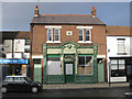
Traditional shop front, Commercial Street, Norton
Freer's Butchers, bearing a datestone of 1912. Business closed down.
Update July 2013: Now trading - again as a butcher's shop.
Image: © Pauline E
Taken: 2 Jan 2012
0.03 miles
4
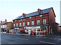
Post Office and shop on Commercial Street, Malton
Showing position of Postbox No. YO17 140.
See Image] for postbox.
Image: © JThomas
Taken: 12 Sep 2020
0.03 miles
5
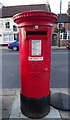
Elizabeth II postbox on Commercial Street, Malton
Image: © JThomas
Taken: 12 Sep 2020
0.03 miles
6
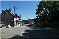
Commercial Street
Looking along Commercial Street in Norton.
Image: © DS Pugh
Taken: 30 May 2021
0.03 miles
7
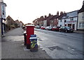
Commercial Street (B1248), Malton
Showing position of Postbox No. YO17 140.
See Image] for postbox.
Image: © JThomas
Taken: 12 Sep 2020
0.04 miles
8
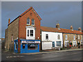
Pizza business, Commercial Street
The stone and red brick building, on the corner of Wallgates Lane, has a datestone of 1904.
Image: © Pauline E
Taken: 2 Jan 2012
0.04 miles
9
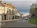
Commercial Street, Norton
View East from the mini roundabout at the bottom of Wold Street.
Image: © Pauline E
Taken: 2 Jan 2012
0.04 miles
10
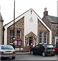
Salvation Army, Malton Corps
The Salvation Army building on Wood Street in Norton. It is odd that this is called Malton Corps as it is in Norton, a town separated from Malton by the River Derwent, and at one time by the county boundary between the North and East Ridings. Malton railway and bus stations are also in Norton as is the Malton bacon factory.
Image: © Gordon Hatton
Taken: 31 Jan 2009
0.05 miles