IMAGES TAKEN NEAR TO
Low Moor, MALTON, YO17 8JX
Introduction
This page details the photographs taken nearby to Low Moor, YO17 8JX by members of the Geograph project.
The Geograph project started in 2005 with the aim of publishing, organising and preserving representative images for every square kilometre of Great Britain, Ireland and the Isle of Man.

There are currently over 7.5m images from over14,400 individuals and you can help contribute to the project by visiting https://www.geograph.org.uk
Image Map
Images are licensed for reuse under creativecommons.org/licenses/by-sa/2.0
Notes
- Clicking on the map will re-center to the selected point.
- The higher the marker number, the further away the image location is from the centre of the postcode.
Image Listing (21 Images Found)
Images are licensed for reuse under creativecommons.org/licenses/by-sa/2.0
Image
Details
Distance
1
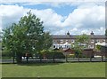
The Sidings
Housing to the northwest of Rillington.
Image: © Barbara Carr
Taken: 15 Jun 2013
0.02 miles
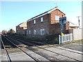
2
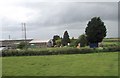
Buildings at the old Rillington junction
Image: © John Firth
Taken: 10 May 2014
0.02 miles
3
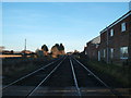
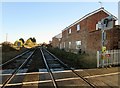
Railway towards Scarborough
Looking north east from Rillington Level Crossing.
Site of the former Rillington railway station.
Image: © JThomas
Taken: 23 Dec 2017
0.09 miles
4
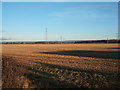
Stubble field, Rillington
Off Low Moor Lane.
Image: © JThomas
Taken: 23 Dec 2017
0.09 miles
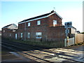
5
Rillington Level Crossing looking eastward
The station was closed on the 22nd of September 1930, ( and demolition followed) so the buildings on the right may or may not be old railway buildings
Image: © Martin Dawes
Taken: 2 Nov 2018
0.11 miles
6
Rillington (Junction) railway station (site), Yorkshire
Opened in 1845 by the York & North Midland Railway, this was the junction where the line from York split. View north east along the current railway line to Scarborough. Just beyond the station, the line to Pickering and Whitby curved away to the left. At one time, this station boasted an overall roof but it closed to passengers as early as 1930.
Image: © Nigel Thompson
Taken: 4 Feb 2008
0.12 miles
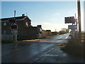
7
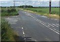
Low Moor Lane
Looking northwest from the level crossing near Rillington.
Image: © Barbara Carr
Taken: 15 Jun 2013
0.13 miles
8
Site of the former Rillington railway station
View from Rillington Level Crossing.
Image: © JThomas
Taken: 23 Dec 2017
0.13 miles
9
Rillington Level Crossing
View south east on Low Moor Lane.
Site of the former Rillington railway station.
Image: © JThomas
Taken: 23 Dec 2017
0.13 miles
10
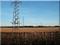
Stubble field and power lines, Rillington
Off Low Moor Lane.
Image: © JThomas
Taken: 23 Dec 2017
0.13 miles