IMAGES TAKEN NEAR TO
Low Moor, MALTON, YO17 8JU
Introduction
This page details the photographs taken nearby to Low Moor, YO17 8JU by members of the Geograph project.
The Geograph project started in 2005 with the aim of publishing, organising and preserving representative images for every square kilometre of Great Britain, Ireland and the Isle of Man.

There are currently over 7.5m images from over14,400 individuals and you can help contribute to the project by visiting https://www.geograph.org.uk
Image Map
Images are licensed for reuse under creativecommons.org/licenses/by-sa/2.0
Notes
- Clicking on the map will re-center to the selected point.
- The higher the marker number, the further away the image location is from the centre of the postcode.
Image Listing (9 Images Found)
Images are licensed for reuse under creativecommons.org/licenses/by-sa/2.0
Image
Details
Distance
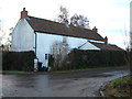
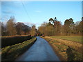
2
Low Moor Lane toward junction
The white house is at the junction of Low Moor South Lane
Image: © Martin Dawes
Taken: 2 Nov 2018
0.06 miles
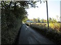
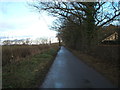
4
Country Lane
Looking to the north edge of the grid square from the entrance to Sleights Farm.
Image: © Stephen Horncastle
Taken: 8 May 2006
0.08 miles
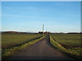
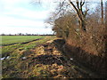
8
Young crop field, The Breckneys
Off Low Moor Lane.
Image: © JThomas
Taken: 23 Dec 2017
0.12 miles
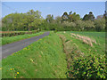
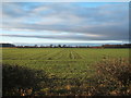
9
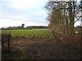
Crop field and trees
Looking west from Low Moor Lane.
Image: © JThomas
Taken: 23 Dec 2017
0.20 miles