
IMAGES TAKEN NEAR TO
Chandlers Wharf, Castlegate, MALTON, YO17 7YL
Introduction
This page details the photographs taken nearby to Chandlers Wharf, Castlegate, YO17 7YL by members of the Geograph project.
The Geograph project started in 2005 with the aim of publishing, organising and preserving representative images for every square kilometre of Great Britain, Ireland and the Isle of Man.

There are currently over 7.5m images from over14,400 individuals and you can help contribute to the project by visiting https://www.geograph.org.uk
Image Map
Images are licensed for reuse under creativecommons.org/licenses/by-sa/2.0
Notes
- Clicking on the map will re-center to the selected point.
- The higher the marker number, the further away the image location is from the centre of the postcode.
Image Listing (246 Images Found)
Images are licensed for reuse under creativecommons.org/licenses/by-sa/2.0
Image
Details
Distance
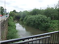
2

Downstream view of the River Derwent from Norton Road
A small island can be seen to the right, as the two short branches of the river rejoin up ahead.
Image: © Pauline E
Taken: 2 Jan 2012
0.03 miles
4
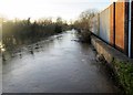
River Derwent in flood at Malton 27th Dec 2015 (12)
From the pedestrian walkway on Castlegate bridge looking downstream with flood defence wall on the right
Image: © Martin Dawes
Taken: 27 Dec 2015
0.04 miles
5
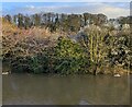
River Derwent and island
Near Malton Bridge.
Image: © JThomas
Taken: 23 Feb 2024
0.04 miles
6
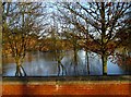
River Derwent in flood at Malton 27th Dec 2015 (5)
From the top of one of the Skateboard Park ramps looking over the flood defence wall, the trees are in a riverside park with seats and picnic tables
Image: © Martin Dawes
Taken: 27 Dec 2015
0.05 miles
7
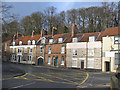
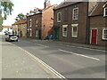
Cottages on Castlegate
Junction of Castlegate and Sheepfoot Hill. The trees behind mark the site of the castle.
Image: © Pauline E
Taken: 2 Jan 2012
0.05 miles
8
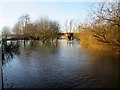
River Derwent in flood at Malton 27th Dec 2015 (6)
Over the flood defence wall alongside Norton Road looking through the riverside park, the lamp post is on the footpath, behind the trees to the left is the skate board park it is behind the flood defence wall, this can be seen going right behind the trees
Image: © Martin Dawes
Taken: 27 Dec 2015
0.05 miles
9
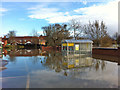
Morrisons car park under water
To the right, over the wall, you can see the high water level of the Derwent.
Image: © Pauline E
Taken: 27 Nov 2012
0.05 miles
10
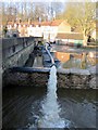
River Derwent in flood at Malton 27th Dec 2015 (13)
Pumping floodwater back into the river over the flood defence wall. A pipe goes into a manhole by the yellow pump. Bridge closed to traffic
Image: © Martin Dawes
Taken: 27 Dec 2015
0.06 miles