IMAGES TAKEN NEAR TO
High Row, MALTON, YO17 6XN
Introduction
This page details the photographs taken nearby to High Row, YO17 6XN by members of the Geograph project.
The Geograph project started in 2005 with the aim of publishing, organising and preserving representative images for every square kilometre of Great Britain, Ireland and the Isle of Man.

There are currently over 7.5m images from over14,400 individuals and you can help contribute to the project by visiting https://www.geograph.org.uk
Image Map
Images are licensed for reuse under creativecommons.org/licenses/by-sa/2.0
Notes
- Clicking on the map will re-center to the selected point.
- The higher the marker number, the further away the image location is from the centre of the postcode.
Image Listing (31 Images Found)
Images are licensed for reuse under creativecommons.org/licenses/by-sa/2.0
Image
Details
Distance
1
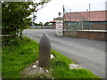
Historical shell casing at Kirby Misperton Village Hall
This historical shell could be better sited.
A villager told me that this shell case and similar ones nearby at Middleton/Aislaby and at Sinnington were given to the villagers after World War One in recognition of the iron and scrap metal that was given by the villagers to be made into munitions for the war effort. The shells came from the Royal Navy. See other picture by Colin Grice. http://www.geograph.org.uk/photo/177560
Image: © Phil Catterall
Taken: 26 Aug 2006
0.01 miles
3
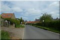
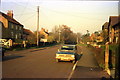
Habton Road entering Kirby Misperton
The Malton to Pickering cycle path has opened this month and follows the road through the village.
Image: © DS Pugh
Taken: 14 May 2022
0.02 miles
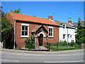
4
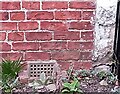
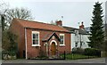
Kirby Misperton, Methodist church
The benchmark is cut into the right hand side of the road facing wall.
Image: © Mel Towler
Taken: 16 Mar 2022
0.03 miles
5
Kirby Misperton, Methodist church
There is a benchmark cut into the right hand side of the road facing wall.
Image: © Mel Towler
Taken: 16 Mar 2022
0.03 miles
7

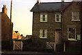
Ducks Farm Close, Kirby Misperton
Presumably this development was built on the former Ducks Farm, named after the owner, John Duck.
Image: © Pauline E
Taken: 3 May 2011
0.07 miles
8

GR pillar box at Kirby Misperton
There is an excellent collection of old photos of the village on this site http://www.kirbymisperton.org.uk/pictures/index.html
Image: © Pauline E
Taken: 3 May 2011
0.07 miles
10
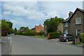
Letterbox on Main Street
The Malton to Pickering cycle path has opened this month and follows the road through the village.
Image: © DS Pugh
Taken: 14 May 2022
0.08 miles