IMAGES TAKEN NEAR TO
Ryton Rigg Road, MALTON, YO17 6RY
Introduction
This page details the photographs taken nearby to Ryton Rigg Road, YO17 6RY by members of the Geograph project.
The Geograph project started in 2005 with the aim of publishing, organising and preserving representative images for every square kilometre of Great Britain, Ireland and the Isle of Man.

There are currently over 7.5m images from over14,400 individuals and you can help contribute to the project by visiting https://www.geograph.org.uk
Image Map
Images are licensed for reuse under creativecommons.org/licenses/by-sa/2.0
Notes
- Clicking on the map will re-center to the selected point.
- The higher the marker number, the further away the image location is from the centre of the postcode.
Image Listing (6 Images Found)
Images are licensed for reuse under creativecommons.org/licenses/by-sa/2.0
Image
Details
Distance
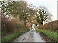
3
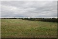
Ryton Riggs
An area of flattish fields close to the River Rye.
Image: © Jonathan Thacker
Taken: 14 Oct 2017
0.15 miles
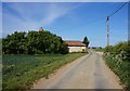
4
Autumn sown cereal crop near Ryton Grange
Image: © Jonathan Thacker
Taken: 14 Oct 2017
0.17 miles
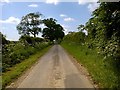
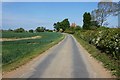
6
Ryton Riggs Road
Looking west along this minor road near Garforth Hall.
Image: © Gordon Hatton
Taken: 12 Dec 2021
0.19 miles