
IMAGES TAKEN NEAR TO
North Street, YORK, YO1 6JF
Introduction
This page details the photographs taken nearby to North Street, YO1 6JF by members of the Geograph project.
The Geograph project started in 2005 with the aim of publishing, organising and preserving representative images for every square kilometre of Great Britain, Ireland and the Isle of Man.

There are currently over 7.5m images from over14,400 individuals and you can help contribute to the project by visiting https://www.geograph.org.uk
Image Map
Images are licensed for reuse under creativecommons.org/licenses/by-sa/2.0
Notes
- Clicking on the map will re-center to the selected point.
- The higher the marker number, the further away the image location is from the centre of the postcode.
Image Listing (3405 Images Found)
Images are licensed for reuse under creativecommons.org/licenses/by-sa/2.0
Image
Details
Distance
1
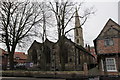
All Saints North Street
for more details about the Church see:
http://allsaints-northstreet.org.uk/
Image: © Michael Jagger
Taken: 30 Dec 2009
0.01 miles
2
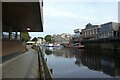
Path beside the Park Inn
Looking towards the Guildhall along the River Ouse.
Image: © DS Pugh
Taken: 25 Sep 2022
0.01 miles
3
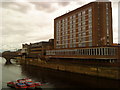
Hotel adjacent to the River Ouse
Built as the Viking Hotel in the mid sixties, it is now known as the Park Inn.
Image: © Andrew Abbott
Taken: 28 Jul 2010
0.01 miles
4
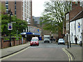
North Street, York
North Street begins at the junction with Tanner Row; the street in the foreground is Wellington Row. The large building with the flags is a 200-bedroom hotel, now known as the Park Inn although it has had various names over the years.
Image: © Stephen McKay
Taken: 24 Apr 2007
0.01 miles
5
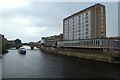
River Ouse and Park Inn
Looking downstream towards Ouse Bridge from the terrace near City Screen Cinema.
Image: © DS Pugh
Taken: 27 Aug 2023
0.01 miles
6
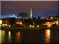
Across the Ouse
Looking across a rather flooded Ouse from outside the cinema on Coney Street on a winter's evening.
Image: © DS Pugh
Taken: 13 Jan 2007
0.01 miles
7
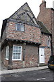
Tudor style house, on North Street
The house is situated just to the right of All Saints Church.
For more details see:
http://allsaints-northstreet.org.uk/
Image: © Michael Jagger
Taken: 30 Dec 2009
0.01 miles
8
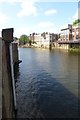
Viking Recorder
Looking along the River Ouse from North Street Gardens. On the left is the Environment Agency river depth recorder called Viking Recorder. The live information can be viewed here: https://flood-warning-information.service.gov.uk/station/8208
Image: © DS Pugh
Taken: 29 May 2016
0.01 miles
9
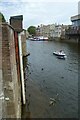
Viking Recorder
Recording a very low level of 0.07 m at this time. The recorder can be viewed at: https://check-for-flooding.service.gov.uk/station/8208
Image: © DS Pugh
Taken: 23 Jul 2022
0.01 miles
10
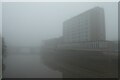
Ouse Bridge and hotel
Looking across the River Ouse and towards Ouse Bridge.
Image: © DS Pugh
Taken: 7 Nov 2020
0.01 miles