
IMAGES TAKEN NEAR TO
Skeldergate, YORK, YO1 6DG
Introduction
This page details the photographs taken nearby to Skeldergate, YO1 6DG by members of the Geograph project.
The Geograph project started in 2005 with the aim of publishing, organising and preserving representative images for every square kilometre of Great Britain, Ireland and the Isle of Man.

There are currently over 7.5m images from over14,400 individuals and you can help contribute to the project by visiting https://www.geograph.org.uk
Image Map
Images are licensed for reuse under creativecommons.org/licenses/by-sa/2.0
Notes
- Clicking on the map will re-center to the selected point.
- The higher the marker number, the further away the image location is from the centre of the postcode.
Image Listing (3131 Images Found)
Images are licensed for reuse under creativecommons.org/licenses/by-sa/2.0
Image
Details
Distance
1
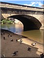
York 'beach'. Under Ouse bridge
Appears when the river is low
Image: © hayley green
Taken: 2 Jun 2013
0.01 miles
2

11-13 Micklegate, York
A pair, dated c1740 with a dentil and modillion (the larger blocks) cornice. Grade II listed.
Shops occupied at the time by a pair of estate agents, Chesterton Humberts and Savills.
Image: © Stephen Richards
Taken: 13 May 2013
0.01 miles
3

Bridge Street York
Viewed looking south from the Ouse Bridge.
Image: © edward mcmaihin
Taken: 21 Jul 2013
0.02 miles

5

Steps down to Queen's Staith
Or they should be. The river is currently in flood and has overtopped the road beside it.
Image: © JThomas
Taken: 23 Feb 2024
0.02 miles

7
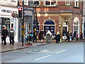
Viking retreat in York
There had been a Viking festival on, but the axe-wielding invaders were retreating peacefully from the city centre.
Image: © Stephen Craven
Taken: 17 Feb 2018
0.02 miles
8

Merchant Exchange
Early 2000s residential block overlooking the River Ouse by Queen's Staith, incorporating the 1849 Varvil's Warehouse (towards the left of the building). Varvil's Warehouse is grade II listed - see https://historicengland.org.uk/listing/the-list/list-entry/1256832?section=official-list-entry. Adjoining the development on the right is 1 Bridge Street, dating from 1815-20 and also grade II listed - see https://historicengland.org.uk/listing/the-list/list-entry/1259343?section=official-list-entry.
Image: © Ian Capper
Taken: 5 Feb 2023
0.02 miles

10
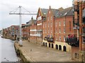
York, Queen's Staith
The City of York grew up as a river port at the confluence of the River Ouse and the River Foss. Under Viking rule, during the ninth and tenth centuries, the city became a major river port, part of the extensive Viking trading routes throughout northern Europe.
Until the end of the 20th century, the Ouse was used by barges to carry freight between York and the port of Hull. The last significant traffic was the supply of newsprint to the local newspaper's Foss-side print works, which continued until 1997. Today navigation is almost exclusively leisure-oriented.
Image: © David Dixon
Taken: 28 Jun 2014
0.02 miles