IMAGES TAKEN NEAR TO
Scarborough Road, BRIDLINGTON, YO16 7PG
Introduction
This page details the photographs taken nearby to Scarborough Road, YO16 7PG by members of the Geograph project.
The Geograph project started in 2005 with the aim of publishing, organising and preserving representative images for every square kilometre of Great Britain, Ireland and the Isle of Man.

There are currently over 7.5m images from over14,400 individuals and you can help contribute to the project by visiting https://www.geograph.org.uk
Image Map
Images are licensed for reuse under creativecommons.org/licenses/by-sa/2.0
Notes
- Clicking on the map will re-center to the selected point.
- The higher the marker number, the further away the image location is from the centre of the postcode.
Image Listing (852 Images Found)
Images are licensed for reuse under creativecommons.org/licenses/by-sa/2.0
Image
Details
Distance
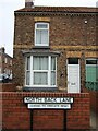
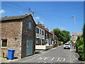
2
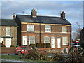
Houses on North Back Lane, Bridlington
Image: © Stefan De Wit
Taken: 3 Jan 2011
0.02 miles
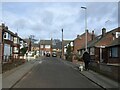
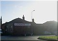
6
Long Lane, Bridlington
Long Lane is a residential street in Bridlington.
Image: © Malc McDonald
Taken: 16 Jun 2021
0.03 miles
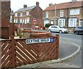
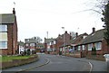
7
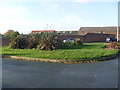
Landscaping beside Scarborough Road, Bridlington
Image: © Stefan De Wit
Taken: 2 Nov 2010
0.03 miles