IMAGES TAKEN NEAR TO
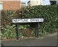
Neptune Drive, BRIDLINGTON, YO16 4EF
Introduction
This page details the photographs taken nearby to Neptune Drive, YO16 4EF by members of the Geograph project.
The Geograph project started in 2005 with the aim of publishing, organising and preserving representative images for every square kilometre of Great Britain, Ireland and the Isle of Man.

There are currently over 7.5m images from over14,400 individuals and you can help contribute to the project by visiting https://www.geograph.org.uk
Image Map
Images are licensed for reuse under creativecommons.org/licenses/by-sa/2.0
Notes
- Clicking on the map will re-center to the selected point.
- The higher the marker number, the further away the image location is from the centre of the postcode.
Image Listing (862 Images Found)
Images are licensed for reuse under creativecommons.org/licenses/by-sa/2.0
Image
Details
Distance
6
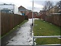
Footpath off South Back Lane, Bridlington
Image: © Stefan De Wit
Taken: 14 Dec 2010
0.03 miles
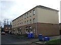
9
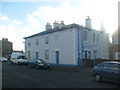
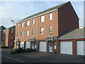
Houses on South Back Lane, Bridlington
Image: © Stefan De Wit
Taken: 1 Nov 2010
0.05 miles
10
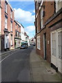
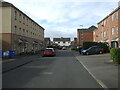
Old Town High Street
The narrow High Street of Old Bridlington, with a number of fine Georgian buildings on either side.
Image: © Richard Law
Taken: 28 Aug 2011
0.05 miles