
IMAGES TAKEN NEAR TO
Cayley Lane, SCARBOROUGH, YO13 9DL
Introduction
This page details the photographs taken nearby to Cayley Lane, YO13 9DL by members of the Geograph project.
The Geograph project started in 2005 with the aim of publishing, organising and preserving representative images for every square kilometre of Great Britain, Ireland and the Isle of Man.

There are currently over 7.5m images from over14,400 individuals and you can help contribute to the project by visiting https://www.geograph.org.uk
Image Map
Images are licensed for reuse under creativecommons.org/licenses/by-sa/2.0
Notes
- Clicking on the map will re-center to the selected point.
- The higher the marker number, the further away the image location is from the centre of the postcode.
Image Listing (180 Images Found)
Images are licensed for reuse under creativecommons.org/licenses/by-sa/2.0
Image
Details
Distance
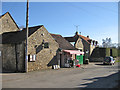
2
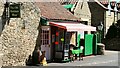
The Old Butchers Shop
The Old Butchers Shop is situated on Cayley Lane.
To see a more northerly (left) photograph of Cayley Lane, click here Image
To see a more southerly (right) photograph of Cayley Lane, click here Image
Image: © Alan Walker
Taken: 30 Apr 2007
0.01 miles
3
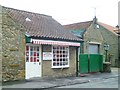
Glaves & Sons butchers shop
Traditional butchers shop in Brompton village.
Image: © Gordon Hatton
Taken: 8 Feb 2014
0.01 miles
4
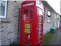
Defibrillator outside the village hall
A new use for an old phone box in the village of Brompton-by-Sawdon.
Image: © Linda Craven
Taken: 10 Dec 2015
0.02 miles
5
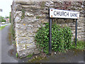
Corner of Church Lane and a bench mark
This is the corner of Church Lane with Cayley Lane. The bench mark on the wall was first recorded on the 1854 O.S map, levelled at 98.6 feet. See also Image]
Image: © John S Turner
Taken: 13 Jun 2011
0.03 miles
6
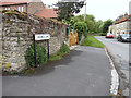
Church Lane, Brompton-by-Sawdon
Looking along Church Lane from its junction with Cayley Lane. There is an old bench mark on the third stone up on the corner of the wall - Image
Image: © John S Turner
Taken: 13 Jun 2011
0.03 miles
7
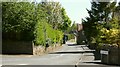
Cayley Lane
The photograph shows the northern end of Cayley Lane at its junction with Image near to the village stores (Image).
The view is looking toward the lanes junction with Church Lane (not obvious but near the parked vehicle).
For a more southerly (ahead) photograph of Cayley Lane but looking back, toward this viewpoint, click here Image
Image: © Alan Walker
Taken: 30 Apr 2007
0.03 miles
8
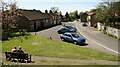
Church Lane
Church Lane, looking in a south-westerly direction toward its junction with Image
Ahead, beyond the crossroads, the lane leads to Image and then on to its junction with West Brow.
To the right (north-easterly) the lane passes Image and then up a short rise to join Image by the Image public house.
To the left a Image leads by the old mill pond and village water supply to Hungate.
For a more south-westerly (ahead) photograph of the lane, but looking back, toward this viewpoint, click here Image
For a more south-westerly (ahead) photograph of the lane, click here Image
Image: © Alan Walker
Taken: 30 Apr 2007
0.03 miles
10
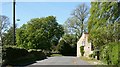
Cayley Lane
The photograph, taken from near its southern end is looking westerly along Cayley Lane toward the point where it turns north, passes Image and reaches its junction with Church Lane.
For another photograph of Cayley Lane taken from the same viewpoint but looking in the opposite direction, click here Image
For a more northerly (ahead) photograph of Cayley Lane, click here Image
Image: © Alan Walker
Taken: 30 Apr 2007
0.04 miles