IMAGES TAKEN NEAR TO
Quarry Bank, SCARBOROUGH, YO13 0JF
Introduction
This page details the photographs taken nearby to Quarry Bank, YO13 0JF by members of the Geograph project.
The Geograph project started in 2005 with the aim of publishing, organising and preserving representative images for every square kilometre of Great Britain, Ireland and the Isle of Man.

There are currently over 7.5m images from over14,400 individuals and you can help contribute to the project by visiting https://www.geograph.org.uk
Image Map
Images are licensed for reuse under creativecommons.org/licenses/by-sa/2.0
Notes
- Clicking on the map will re-center to the selected point.
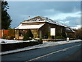
- The higher the marker number, the further away the image location is from the centre of the postcode.
Image Listing (21 Images Found)
Images are licensed for reuse under creativecommons.org/licenses/by-sa/2.0
Image
Details
Distance
4
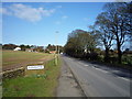
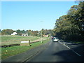
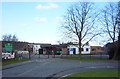
Entering Cloughton
Heading north on Mill Lane (A171).
Image: © JThomas
Taken: 27 Feb 2016
0.10 miles
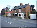
5
A171 Mill Lane at Cloughton village boundary
Image: © Colin Pyle
Taken: 2 Nov 2015
0.11 miles
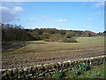
8
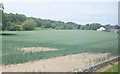
Farmland north of Burniston
The crop is growing with - at last! - a bit of summer warmth, but with blank patches where unremitting winter and spring rain collected, rotting the seed.
Image: © Barbara Carr
Taken: 20 Jun 2013
0.17 miles
10
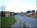
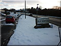
Bus stop and shelter on Mill Lane, Burniston
Image: © JThomas
Taken: 27 Feb 2016
0.18 miles