IMAGES TAKEN NEAR TO
Burniston Industrial Estate, Willymath Close, SCARBOROUGH, YO13 0HG
Introduction
This page details the photographs taken nearby to Burniston Industrial Estate, Willymath Close, YO13 0HG by members of the Geograph project.
The Geograph project started in 2005 with the aim of publishing, organising and preserving representative images for every square kilometre of Great Britain, Ireland and the Isle of Man.

There are currently over 7.5m images from over14,400 individuals and you can help contribute to the project by visiting https://www.geograph.org.uk
Image Map
Images are licensed for reuse under creativecommons.org/licenses/by-sa/2.0
Notes
- Clicking on the map will re-center to the selected point.
- The higher the marker number, the further away the image location is from the centre of the postcode.
Image Listing (39 Images Found)
Images are licensed for reuse under creativecommons.org/licenses/by-sa/2.0
Image
Details
Distance
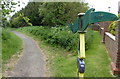
1

NCN marker
A National Cycle Network marker at Burniston.
Image: © T Eyre
Taken: 15 May 2022
0.04 miles
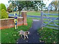
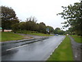
2
Millennium Milepost, National Cycle Route 1, Burniston
Image: © JThomas
Taken: 27 Feb 2016
0.04 miles
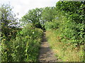
3

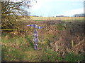
The Cinder Track at A165, south of Burniston
Image: © Robert Eva
Taken: 16 May 2019
0.05 miles
4
NCR 1 route marker
The Cinder Track approaching the A165.
Image: © Chris McAuley
Taken: 26 Oct 2013
0.05 miles
5
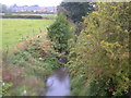
The old Scarborough to Whitby line at Burniston
Image: © Mat Fascione
Taken: 22 May 2018
0.06 miles
7
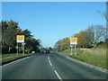
A165 Coastal Road at Burniston village boundary
Image: © Colin Pyle
Taken: 2 Nov 2015
0.10 miles
9

Old Scarborough to Whitby Railway near Burniston
Image: © JThomas
Taken: 4 Sep 2009
0.11 miles