
IMAGES TAKEN NEAR TO
Staintondale, SCARBOROUGH, YO13 0EZ
Introduction
This page details the photographs taken nearby to YO13 0EZ by members of the Geograph project.
The Geograph project started in 2005 with the aim of publishing, organising and preserving representative images for every square kilometre of Great Britain, Ireland and the Isle of Man.

There are currently over 7.5m images from over14,400 individuals and you can help contribute to the project by visiting https://www.geograph.org.uk
Image Map
Images are licensed for reuse under creativecommons.org/licenses/by-sa/2.0
Notes
- Clicking on the map will re-center to the selected point.
- The higher the marker number, the further away the image location is from the centre of the postcode.
Image Listing (31 Images Found)
Images are licensed for reuse under creativecommons.org/licenses/by-sa/2.0
Image
Details
Distance
2
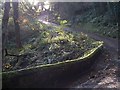
Downdale Road, Staintondale
Heading towards Staintondale from the Shire Horse Centre, Whitestone Farm is behind the trees, top left.
Image: © Paul Grainger
Taken: Unknown
0.07 miles
3
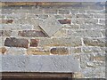
Detail of datestone
A detail of the datestone on the barn at Whitehouse Farm shown in Image which reads 1737 or possibly 1787; it is not entirely clear on site
Image: © Christopher Hall
Taken: 31 Aug 2024
0.08 miles
5
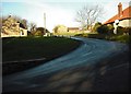
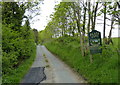
Hairpin Bend, Whitehouse Farm
Taken from where the bridleway from the Staintondale Road shown on Image enters, the road to Whitehouse Farm rises steeply from the valley of Hayburn Beck and makes a hairpin bend towards the farm buildings.
Image: © Christopher Hall
Taken: 20 Dec 2013
0.09 miles
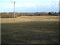
7
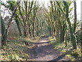
National Cycle Route 1
Heading south on the former Scarborough to Whitby Railway.
Image: © JThomas
Taken: 27 Feb 2016
0.13 miles
8
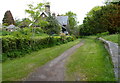
The former Staintondale Railway Station
Image: © Mat Fascione
Taken: 23 May 2018
0.13 miles
9
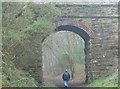
Road Bridge
The bridge crosses the disused railway line which runs from Scarborough to Whitby. This bridleway can be used an alternative route to the Cleveland Way between Hayburn Wyke and Ravenscar, the route is easier to navigate in the mist.
Image: © Christine Church
Taken: 13 Apr 2007
0.14 miles
