IMAGES TAKEN NEAR TO
Suffield Hill, SCARBOROUGH, YO13 0BH
Introduction
This page details the photographs taken nearby to Suffield Hill, YO13 0BH by members of the Geograph project.
The Geograph project started in 2005 with the aim of publishing, organising and preserving representative images for every square kilometre of Great Britain, Ireland and the Isle of Man.

There are currently over 7.5m images from over14,400 individuals and you can help contribute to the project by visiting https://www.geograph.org.uk
Image Map
Images are licensed for reuse under creativecommons.org/licenses/by-sa/2.0
Notes
- Clicking on the map will re-center to the selected point.
- The higher the marker number, the further away the image location is from the centre of the postcode.
Image Listing (9 Images Found)
Images are licensed for reuse under creativecommons.org/licenses/by-sa/2.0
Image
Details
Distance
1

Beware escaping cows
The lane to Prospect Hill Farm. The request to close the gate has been ignored.
Image: © Christine Johnstone
Taken: 16 Nov 2011
0.03 miles
2

Autumnal bank of bracken
On the south side of Hay Lane.
Image: © Christine Johnstone
Taken: 16 Nov 2011
0.04 miles
3

Footpath sign, east of Hay Lane
Opposite a few isolated houses.
Image: © Christine Johnstone
Taken: 16 Nov 2011
0.05 miles
4
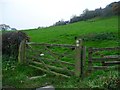
Field gate with two footpath waymarks
The one to the right goes to Suffield, the one to the left to Scalby Nabs.
Image: © Christine Johnstone
Taken: 16 Nov 2011
0.05 miles
5

Roadside trees covered in ivy
In summer you wouldn't know the extent of the colonisation.
Image: © Christine Johnstone
Taken: 16 Nov 2011
0.05 miles
6

Hay Brow
A public footpath to Suffield.
Image: © Christine Johnstone
Taken: 16 Nov 2011
0.05 miles
7

Road leading to Suffield
Taken near Scalby Nab.
Image: © Ian S
Taken: 15 Jul 2019
0.06 miles
8

Footpath, Hay Brow
The footpath from Limestone lane shown in Image and Image turns a drops steeply down as a well graded track to Hay Lane
Image: © Christopher Hall
Taken: 23 Apr 2014
0.10 miles