
IMAGES TAKEN NEAR TO
Norwood Street, SCARBOROUGH, YO12 7EG
Introduction
This page details the photographs taken nearby to Norwood Street, YO12 7EG by members of the Geograph project.
The Geograph project started in 2005 with the aim of publishing, organising and preserving representative images for every square kilometre of Great Britain, Ireland and the Isle of Man.

There are currently over 7.5m images from over14,400 individuals and you can help contribute to the project by visiting https://www.geograph.org.uk
Image Map
Images are licensed for reuse under creativecommons.org/licenses/by-sa/2.0
Notes
- Clicking on the map will re-center to the selected point.
- The higher the marker number, the further away the image location is from the centre of the postcode.
Image Listing (389 Images Found)
Images are licensed for reuse under creativecommons.org/licenses/by-sa/2.0
Image
Details
Distance
1
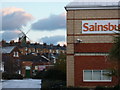
Give us our daily bread
The old and the new way to buy our bread.
Image: © Ian S
Taken: 27 Nov 2010
0.02 miles
3
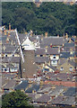
Scarborough windmill
Hemmed in on all sides by the town streets and houses, the mill is 18th century, Grade II listed. Zoomed shot from the viewpoint on Oliver's Mount. In use as a B&B.
Image: © Pauline E
Taken: 21 Jul 2014
0.03 miles
4
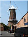
Scarborough Mill
A very unusual sight a windmill in an urban environment this mill in the centre of Scarborough is now a guest house see http://www.a1tourism.com/uk/oldmillhotel.html for more info
Image: © Glyn Baker
Taken: 10 Jun 2006
0.03 miles
5
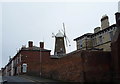
Scarborough Mill
Now a B & B.
View from Belle Vue Street.
Image: © JThomas
Taken: 20 Feb 2016
0.03 miles
6

Car park at Sainsbury's, Scarborough
Image: © Stephen Sweeney
Taken: 12 Jun 2017
0.04 miles
7

Demolition of Allatt House complete
The demolition of the buildings at the end of West Parade Road first shown in Image is now complete and the site cleared. This has opened up a view of the windmill on Mill Street off Victoria Road
Image: © Christopher Hall
Taken: 15 Jul 2014
0.05 miles
8
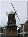
Scarborough Corn Mill
Formerly called The Common Mill and built over 220 years ago. In 1854 it remained isolated a short distance west of the railway station but less than 40 years later was engulfed by the town's expansion.
Image: © David Rogers
Taken: 8 Mar 2009
0.06 miles
9

Demolition of Allatt House
Allatt House is located off a small road known as West Parade. It was previously occupied by what is now known as Coast & Vale Community Action who have moved to The Street, shown in Image The site is to be redeveloped for housing.
Image: © Christopher Hall
Taken: 2 Jul 2014
0.06 miles
10
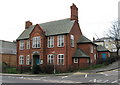
St Saviour's Church Hall
Erected in 1915 on Gladstone Road.
Image: © David Rogers
Taken: 8 Mar 2009
0.06 miles