IMAGES TAKEN NEAR TO
Mowthorpe, SCARBOROUGH, YO12 5TB
Introduction
This page details the photographs taken nearby to Mowthorpe, YO12 5TB by members of the Geograph project.
The Geograph project started in 2005 with the aim of publishing, organising and preserving representative images for every square kilometre of Great Britain, Ireland and the Isle of Man.

There are currently over 7.5m images from over14,400 individuals and you can help contribute to the project by visiting https://www.geograph.org.uk
Image Map
Images are licensed for reuse under creativecommons.org/licenses/by-sa/2.0
Notes
- Clicking on the map will re-center to the selected point.
- The higher the marker number, the further away the image location is from the centre of the postcode.
Image Listing (44 Images Found)
Images are licensed for reuse under creativecommons.org/licenses/by-sa/2.0
Image
Details
Distance
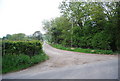
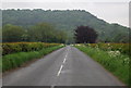
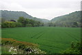
7
Looking towards Thorn Park Farm
The trees line Thorn Park (a drainage ditch), the farm can just be seen behind the trees.
Image: © N Chadwick
Taken: 1 Jun 2010
0.11 miles
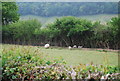
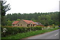
10
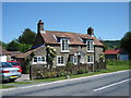
Mowthorpe Cottage
On the south side of the Sea Cut near Mowthorpe Bridge
Image: © Martin Dawes
Taken: 24 Jun 2009
0.14 miles