
IMAGES TAKEN NEAR TO
Springhill Lane, SCARBOROUGH, YO12 5NE
Introduction
This page details the photographs taken nearby to Springhill Lane, YO12 5NE by members of the Geograph project.
The Geograph project started in 2005 with the aim of publishing, organising and preserving representative images for every square kilometre of Great Britain, Ireland and the Isle of Man.

There are currently over 7.5m images from over14,400 individuals and you can help contribute to the project by visiting https://www.geograph.org.uk
Image Map
Images are licensed for reuse under creativecommons.org/licenses/by-sa/2.0
Notes
- Clicking on the map will re-center to the selected point.
- The higher the marker number, the further away the image location is from the centre of the postcode.
Image Listing (53 Images Found)
Images are licensed for reuse under creativecommons.org/licenses/by-sa/2.0
Image
Details
Distance
1
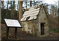
Conduit house in Falsgrave Park
The area occupied by modern Falsgrave Park was important to the development of the medieval Scarborough as it was the location of springs tapped by the Franciscan Friars in 1319 to provide a water supply for both themselves and the townspeople.
The springs were tapped by means of two conduit houses; the first one of 1319 and a second of 1339. This stone building was erected in the 18th century by the residents of Falsgrave (at that time a separate settlement) to provide their water supply but it is known that it is exactly on the site of the 1319 Franciscan conduit house. .
Image: © Christopher Hall
Taken: 30 Nov 2013
0.05 miles
3
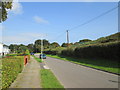
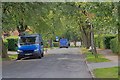
Spring Hill Lane
To the right the covered reservoir and beyond Falsgrave Park
Image: © Martin Dawes
Taken: 10 Sep 2014
0.06 miles
4
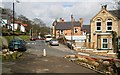
Junction of Oak Road and Park Avenue
This north north-westerly facing photograph is of the junction of Image (joining from the right) and Park Avenue (ahead).
The viewpoint is at Image
Road name information from OS Maps.
Image: © Alan Walker
Taken: 9 Apr 2008
0.08 miles
5
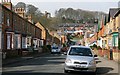
Oak Road
This west south-westerly facing photograph is of Oak Road looking toward its junction with Park Avenue.
The building on the hilltop is Red House on Springhill Lane.
For another photograph of Oak Road taken from approximately the same viewpoint but facing the opposite direction, click here Image
For a photograph of Oak Road taken from the Image (ahead) and looking back toward this viewpoint, click here Image
Road name information from OS Maps.
Image: © Alan Walker
Taken: 9 Apr 2008
0.09 miles
6
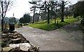
The northern entrance to Falsgrave Park
The photograph is of the northern entrance to Falsgrave Park and was taken from the near to the Image
For another, more southerly (ahead) photograph of Falsgrave Park, taken by John Davis, click here Image
Road name information from OS Maps.
Image: © Alan Walker
Taken: 9 Apr 2008
0.09 miles
7
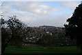
Falsgrave Park
Falsgrave Park was developed from the 1880s to provide for the open space needs of the growing number of residents of Falsgrave which becoming a suburb of Scarborough; much terrace housing was being built.
It also has good views towards the medieval town of Scarborough with the castle on the skyline
Image: © Christopher Hall
Taken: 30 Nov 2013
0.10 miles
8
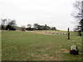
Falsgrave Park and its stone circle
Falsgrave Park has woods and a large wildflower meadow at the top. There is also a stone circle, a totem pole, and a carved wooden owl to add more interest. There is a Friends of Falsgrave Park group http://www.scarborough.gov.uk/default.aspx?page=11883
Image: © John S Turner
Taken: 4 Feb 2012
0.11 miles
9

Carved owl in Falsgrave Park
The carved owl stands at the top of Falsgrave Park in front of the water reservoir and close to the wildflower meadow. The area was improved in 2003. There is a Friends of Falsgrave Park group http://www.scarborough.gov.uk/default.aspx?page=11883
Image: © John S Turner
Taken: 4 Feb 2012
0.11 miles
10
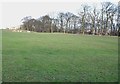
Falsgrave Park top field
The depressions are said to be the result of the digging of practice trenches during World war I
Image: © Christopher Hall
Taken: 30 Nov 2013
0.12 miles