
IMAGES TAKEN NEAR TO
Scarborough Road, SCARBOROUGH, YO12 4RE
Introduction
This page details the photographs taken nearby to Scarborough Road, YO12 4RE by members of the Geograph project.
The Geograph project started in 2005 with the aim of publishing, organising and preserving representative images for every square kilometre of Great Britain, Ireland and the Isle of Man.

There are currently over 7.5m images from over14,400 individuals and you can help contribute to the project by visiting https://www.geograph.org.uk
Image Map
Images are licensed for reuse under creativecommons.org/licenses/by-sa/2.0
Notes
- Clicking on the map will re-center to the selected point.
- The higher the marker number, the further away the image location is from the centre of the postcode.
Image Listing (42 Images Found)
Images are licensed for reuse under creativecommons.org/licenses/by-sa/2.0
Image
Details
Distance
1
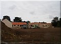
New development, Seamer
This new development of social housing by Flower Fund Homes is on the site of former farm buildings at the junction of Scarborough Road and Main Street
Image: © Christopher Hall
Taken: 13 Sep 2014
0.06 miles
4
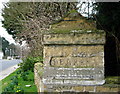
Seamer Milestone
At the junction of Eastgate with Main Street on the boundary wall of Milestone House. The stone is very worn and difficult to read.
Image: © David Rogers
Taken: 13 Mar 2009
0.08 miles
5
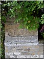
Old stone road sign
This is the old stone road sign at the junction of Eastgate and Main Street referred to in Image
Image: © Christopher Hall
Taken: 13 Sep 2014
0.08 miles
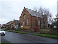
7
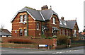
The Old School House Seamer
At the junction of School House Drive and the B1261 Main Street.
Image: © David Rogers
Taken: 13 Mar 2009
0.09 miles
8
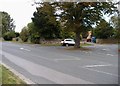
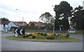
Street tree, Eastgate, Seamer
The street tree on the traffic island is at the junction of Eastgate which runs off the right with the B1261 Main Street. Eastgate used to be the main road to Scarborough before the turnpike was built and there is a stone road sign in the wall beyond the tree. The B1261 used to be the A64 Scarborough to York road until the village was by-passed about 30 years ago.
Image: © Christopher Hall
Taken: 13 Sep 2014
0.09 miles
10
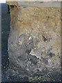
Very weathered bench mark on #1 Main Street, Seamer
The only part of this bench mark that is really visible is the bottom of the right hand leg of the arrowhead. #1 Main Street is at the junction with Eastgate. See also Image
Image: © John S Turner
Taken: 20 Jun 2012
0.09 miles