
IMAGES TAKEN NEAR TO
North Street, SCARBOROUGH, YO11 3UA
Introduction
This page details the photographs taken nearby to North Street, YO11 3UA by members of the Geograph project.
The Geograph project started in 2005 with the aim of publishing, organising and preserving representative images for every square kilometre of Great Britain, Ireland and the Isle of Man.

There are currently over 7.5m images from over14,400 individuals and you can help contribute to the project by visiting https://www.geograph.org.uk
Image Map
Images are licensed for reuse under creativecommons.org/licenses/by-sa/2.0
Notes
- Clicking on the map will re-center to the selected point.
- The higher the marker number, the further away the image location is from the centre of the postcode.
Image Listing (63 Images Found)
Images are licensed for reuse under creativecommons.org/licenses/by-sa/2.0
Image
Details
Distance
1

Bench with a view of Flixton
On a small green at the junction of North Street and Flixton Carr Lane.
Image: © Christine Johnstone
Taken: 9 Aug 2022
0.03 miles
2

Flixton Carr Lane, Flixton
This is the point where North Street, shown further south in Image has become Flixton Carr Lane. Diverting to the left is a track designated a bridleway to Woodhouse Farm. Photo Image is taken further east along this track. A small village green has been created at the junction.
Image: © Christopher Hall
Taken: 8 Jan 2014
0.04 miles
3

North Street, Flixton
Runs out of the village, passing Park House Farm before becoming Flixton Carr Lane. The road then runs north for about a kilometre to Flixton Bridge, where it peters out into pastures.
Image: © Chris Heaton
Taken: 31 Mar 2025
0.04 miles
4

Heading North out of Flixton
Flixton Carr Lane stretches nortwards for about a kilometre, where it fades into fields after crossing the River Hertford
Image: © Chris Heaton
Taken: 31 Mar 2025
0.04 miles

6
![Spring House [pumping station], Flixton Carr Lane](https://s2.geograph.org.uk/geophotos/07/37/76/7377646_755a9b9c_120x120.jpg)
Spring House [pumping station], Flixton Carr Lane
Built on top of a spring which is shown on the old large-scale OS maps. Managed by Yorkshire Water.
Image: © Christine Johnstone
Taken: 9 Aug 2022
0.08 miles
7

North Street, Flixton
North street runs north from the main street to Flixton Carr and the River Hertford. Close to the signs marking the end of the 30mph speed limit it becomes Flixton Carr Lane.
Image: © Christopher Hall
Taken: 8 Jan 2014
0.08 miles

9

Farm Track heading off Flixton Carr Lane
Image: © Chris Heaton
Taken: 31 Mar 2025
0.10 miles
10
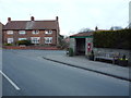
Bus stop and shelter on Main Street, Flixton
Showing position of Postbox No. YO11 76.
See Image] for postbox.
Image: © JThomas
Taken: 25 Mar 2016
0.10 miles