IMAGES TAKEN NEAR TO
Station Road, SCARBOROUGH, YO11 3TL
Introduction
This page details the photographs taken nearby to Station Road, YO11 3TL by members of the Geograph project.
The Geograph project started in 2005 with the aim of publishing, organising and preserving representative images for every square kilometre of Great Britain, Ireland and the Isle of Man.

There are currently over 7.5m images from over14,400 individuals and you can help contribute to the project by visiting https://www.geograph.org.uk
Image Map
Images are licensed for reuse under creativecommons.org/licenses/by-sa/2.0
Notes
- Clicking on the map will re-center to the selected point.
- The higher the marker number, the further away the image location is from the centre of the postcode.
Image Listing (19 Images Found)
Images are licensed for reuse under creativecommons.org/licenses/by-sa/2.0
Image
Details
Distance
4

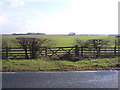
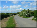
Road to Mayville Dairy Farm
Off National Cycle Route 1.
Image: © JThomas
Taken: 13 Feb 2016
0.17 miles
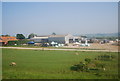
5
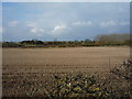
Stubble field near Mayville Dairy Farm
West of National Cycle Route 1.
Image: © JThomas
Taken: 13 Feb 2016
0.17 miles
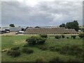
6
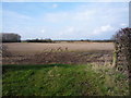
Stubble field west of National Cycle Route 1
Image: © JThomas
Taken: 13 Feb 2016
0.18 miles
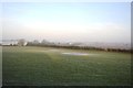
8
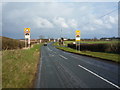
Approaching level crossing on Carr Lane
Heading north on National Cycle Route 1.
Image: © JThomas
Taken: 13 Feb 2016
0.20 miles
9
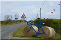
Straw bicycle
Looking towards the level crossing, hence the queues likely signs. The bicycle is to celebrate the Tour de Yorkshire, with stage one having passed the previous day.
Image: © DS Pugh
Taken: 2 May 2015
0.20 miles