
IMAGES TAKEN NEAR TO
Seafield Avenue, SCARBOROUGH, YO11 3QF
Introduction
This page details the photographs taken nearby to Seafield Avenue, YO11 3QF by members of the Geograph project.
The Geograph project started in 2005 with the aim of publishing, organising and preserving representative images for every square kilometre of Great Britain, Ireland and the Isle of Man.

There are currently over 7.5m images from over14,400 individuals and you can help contribute to the project by visiting https://www.geograph.org.uk
Image Map
Images are licensed for reuse under creativecommons.org/licenses/by-sa/2.0
Notes
- Clicking on the map will re-center to the selected point.
- The higher the marker number, the further away the image location is from the centre of the postcode.
Image Listing (65 Images Found)
Images are licensed for reuse under creativecommons.org/licenses/by-sa/2.0
Image
Details
Distance
1
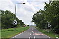
A165 at Osgodby - closed permanently due to subsidence
Image: © Nick Mutton 01329 000000
Taken: 3 Jul 2010
0.05 miles
2
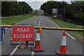
A165 at Osgodby - closed permanently due to subsidence
Image: © Nick Mutton 01329 000000
Taken: 3 Jul 2010
0.05 miles
5
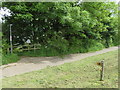
Cleveland Way above Cayton Bay at Osgodby Hill
The Cleveland Way seems to have been re-routed above Cayton Bay at Osgodby Hill. Here, alongside the by-passed Scarborough to Filey road, the footpath leaves Osgodby Hill to return to the original route. A few metres past the footpath junction there is an old milestone hidden in the undergrowth beneath the trees - Image
Image: © John S Turner
Taken: 16 Jun 2016
0.06 miles
6
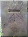
Bench mark on old milestone on Osgodby Hill
This Ordnance Survey bench mark is on the back of the old milestone on Osgodby Hill. The milestone is set back from the path and the by-passed Scarborough to Filey road, so is not immediately obvious unless you look for it. See also Image
Image: © John S Turner
Taken: 16 Jun 2016
0.06 miles
7
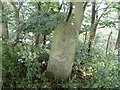
Old milestone on Osgodby Hill, above Cayton Bay
This old milestone once read 'Scarborough 3', but that's not visible today, neither is the stone immediately visible from the footpath alongside the by-passed Scarborough to Filey road. It is about 5 metres south of where the Cleveland Way turns east towards Cayton Bay, and then set back in the undergrowth under the trees. Also there is an Ordnance Survey bench mark on the back of the stone - Image
Image: © John S Turner
Taken: 16 Jun 2016
0.06 miles
8
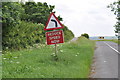
A165 at Osgodby - closed permanently due to subsidence
Image: © Nick Mutton 01329 000000
Taken: 3 Jul 2010
0.06 miles
9
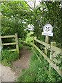
Cleveland Way footpath to Cayton Bay
The Cleveland Way seems to have been re-routed above Cayton Bay at Osgodby Hill. Here, alongside the by-passed Scarborough to Filey road, the footpath leaves Osgodby Hill to return to the original route. See also Image
Image: © John S Turner
Taken: 16 Jun 2016
0.06 miles
10
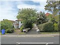
Houses on Filey Road
One house has set out a substantial range of home products for sale. Filey Road is closed a short distance south of this point, although still allowing free passage for cycles.
Image: © Oliver Dixon
Taken: 18 May 2022
0.06 miles