
IMAGES TAKEN NEAR TO
Back Trinity Road, SCARBOROUGH, YO11 2TB
Introduction
This page details the photographs taken nearby to Back Trinity Road, YO11 2TB by members of the Geograph project.
The Geograph project started in 2005 with the aim of publishing, organising and preserving representative images for every square kilometre of Great Britain, Ireland and the Isle of Man.

There are currently over 7.5m images from over14,400 individuals and you can help contribute to the project by visiting https://www.geograph.org.uk
Image Map
Images are licensed for reuse under creativecommons.org/licenses/by-sa/2.0
Notes
- Clicking on the map will re-center to the selected point.
- The higher the marker number, the further away the image location is from the centre of the postcode.
Image Listing (155 Images Found)
Images are licensed for reuse under creativecommons.org/licenses/by-sa/2.0
Image
Details
Distance
1
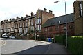
Victoria Memorial Hall, Westbourne Grove
This is the point where Westbourne Grove makes a sharp left hand bend. On the right can be seen the apsidal end of Holy Trinity Church opened in 1880.The terrace of large buff brick houses is circa 1875-80.Between the two is the hall for Holy Trinity called Victoria Memorial Hall designed in 1902 by Demaine & Brierley of York and opened the following year. It was intended to be used as a gymnasium and drill room for the Church Lads Brigade and had space for 400 people. It is now residential.
Holy trinity can also be seen in Image
Image: © Christopher Hall
Taken: 8 Apr 2014
0.01 miles
2

Plaque on Victoria Memorial Hall
Detail of a marble commemorative plaque on the hall shown in Image
Image: © Christopher Hall
Taken: 11 Dec 2013
0.02 miles

4
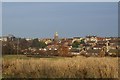
Holy Trinity Church viewed from near Weaponness Valley car park
The view is from open unused land just south of Weaponness Valley car park, across housing in the Weaponness area to the tower of Holy Trinity Church. The nearer housing dates from the 1960s whilst that closer to the church is late 19th century.
Image: © Christopher Hall
Taken: 20 Jan 2014
0.02 miles
5
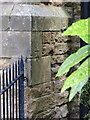
Bench mark on Holy Trinity church, Scarborough
Although the Ordnance Survey state that this mark is on the west face of the church, it does actually face south at the south west corner of the west face. For details of the mark see http://www.bench-marks.org.uk/bm69327
Trinity Road is behind the camera - see also Image
Image: © John S Turner
Taken: 30 Jun 2014
0.02 miles
6
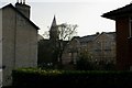
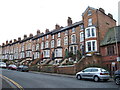
Holy Trinity Church from Westwood
Viewed through a gap in the buildings in Westwood is holy Trinity Church which is also shown in Image To the right is a block of Council flats at the junction of Valley Road and Westbourne Grove - see Image These flats were built in 1993, the designers being Scarborough Borough council Architect's Dept.
Image: © Christopher Hall
Taken: 20 Jan 2014
0.03 miles
8

Trinity Road past Holy Trinity, Scarborough
Looking along Trinity Road past one of the entrances to Holy Trinity. There is an Ordnance Survey bench mark on the church wall just to the right of the iron railings - see Image
Image: © John S Turner
Taken: 30 Jun 2014
0.03 miles
9
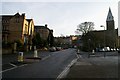
Westbourne Grove/Trinity Road junction
The main road is Westbourne Grove with Trinity Road going off to the right. The focus of the junction is Holy Trinity Church a distant view of which appears in Image In front is some green space sometimes known as Westbourne Green.
Image: © Christopher Hall
Taken: 20 Jan 2014
0.04 miles
10
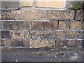
Bench mark between 2-3 Oriel Crescent, Scarborough
This bench mark is on the old low brick wall between #2-3 Oriel Crescent, and opposite the Oriel Cricket and Recreation Ground. The brick pillar above the mark has been rebuilt using modern bricks, but the low wall hasn't changed. See also Image
Image: © John S Turner
Taken: 11 May 2010
0.05 miles