
IMAGES TAKEN NEAR TO
St. Martins Place, SCARBOROUGH, YO11 2QH
Introduction
This page details the photographs taken nearby to St. Martins Place, YO11 2QH by members of the Geograph project.
The Geograph project started in 2005 with the aim of publishing, organising and preserving representative images for every square kilometre of Great Britain, Ireland and the Isle of Man.

There are currently over 7.5m images from over14,400 individuals and you can help contribute to the project by visiting https://www.geograph.org.uk
Image Map
Images are licensed for reuse under creativecommons.org/licenses/by-sa/2.0
Notes
- Clicking on the map will re-center to the selected point.
- The higher the marker number, the further away the image location is from the centre of the postcode.
Image Listing (359 Images Found)
Images are licensed for reuse under creativecommons.org/licenses/by-sa/2.0
Image
Details
Distance
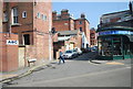
2
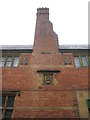
Chimney of the former St Martin's Grammar School
This is the chimney on the side of the former St Martin's Grammar School viewed from St Martin's Place. Note the impressive 'M' shaped tie bars on either side of the chimney. The carved stone panel in the centre is also an 'M'. The Grammar School was built in 1870 at a time when the South Cliff area was being developed rapidly, however, the school closed in 1922 and today it is a Christian Science Reading Room.
Image: © John S Turner
Taken: 6 Oct 2009
0.03 miles
3
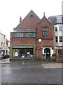
Former St Martin's Grammar School, Ramshill Road
This is the former St Martin's Grammar School viewed from across Ramshill Road. The Grammar School was built in 1870 at a time when the South Cliff area was being developed rapidly, however, the school closed in 1922 and today it is a Christian Science Reading Room. St Martin's Place is on the left of the building.
Image: © John S Turner
Taken: 6 Oct 2009
0.03 miles
4
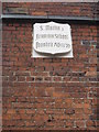
Plaque on the former St Martin's Grammar School
This plaque is above the front door of the former St Martin's Grammar School in Ramshill Road. The Grammar School was built in 1870 at a time when the South Cliff area of Scarborough was being developed rapidly, however, the school closed in 1922 and today it is a Christian Science Reading Room.
Image: © John S Turner
Taken: 6 Oct 2009
0.03 miles
5
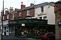
Shops on Ramshill Road
These buildings pre-date the development of Ramshill Road as a shopping street. This was originally a row of houses with front gardens but subsequently the gardens were developed as shops in front of the houses to a uniform design the character of which has been retained. St Martin's Place goes off to the right
Image: © Christopher Hall
Taken: 27 Nov 2013
0.03 miles
6
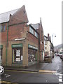
Former St Martin's Grammar School, Ramshill Road
This is the former St Martin's Grammar School viewed from across St Martin's Place. The Grammar School was built in 1870 at a time when the South Cliff area was being developed rapidly, however, the school closed in 1922 and today it is a Christian Science Reading Room. The building faces onto Ramshill Road.
Image: © John S Turner
Taken: 6 Oct 2009
0.03 miles

9
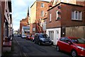
St Martin's Lane
St Martin's lane is the rear service lane to the properties in West Street shown in Image, the backs of which are seen on the right. On the left are small houses and towards the far end of the lane a mix of uses. The spite to St Andrew's church is seen in the background.
Image: © Christopher Hall
Taken: 1 Feb 2014
0.05 miles
10
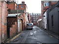
St. Martins Road, Scarborough
Off Ramshill Road (A165).
Image: © JThomas
Taken: 13 Feb 2016
0.05 miles