
IMAGES TAKEN NEAR TO
Cromwell Terrace, SCARBOROUGH, YO11 2DT
Introduction
This page details the photographs taken nearby to Cromwell Terrace, YO11 2DT by members of the Geograph project.
The Geograph project started in 2005 with the aim of publishing, organising and preserving representative images for every square kilometre of Great Britain, Ireland and the Isle of Man.

There are currently over 7.5m images from over14,400 individuals and you can help contribute to the project by visiting https://www.geograph.org.uk
Image Map
Images are licensed for reuse under creativecommons.org/licenses/by-sa/2.0
Notes
- Clicking on the map will re-center to the selected point.
- The higher the marker number, the further away the image location is from the centre of the postcode.
Image Listing (202 Images Found)
Images are licensed for reuse under creativecommons.org/licenses/by-sa/2.0
Image
Details
Distance
1
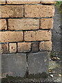
Weathered benchmark between #9 and #7 Westborough Grove
A weathered Ordnance Survey benchmark on the central pillar between the entrances to #9 and #7 Westborough Grove. For a wider view see Image
Image: © John S Turner
Taken: 22 Apr 2023
0.03 miles
2
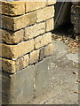
Weathered bench mark in Westbourne Grove, Scarborough
This very weathered bench mark is on the brick pier between #7-9 Westbourne Grove. See also Image For more details of the mark see: http://www.bench-marks.org.uk/bm69271
Image: © John S Turner
Taken: 30 Jun 2014
0.04 miles
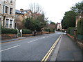
4
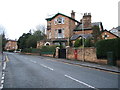
Westbourne Grove, Scarborough
Looking east showing position of Postbox No. YO11 163.
See Image] for postbox.
Image: © JThomas
Taken: 20 Feb 2016
0.04 miles
5
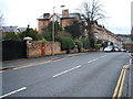
Westbourne Grove, Scarborough
Looking west showing position of Postbox No. YO11 163.
See Image] for postbox.
Image: © JThomas
Taken: 20 Feb 2016
0.04 miles
6
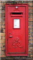
Close up, George VI postbox on Westbourne Grove, Scarborough
Postbox No. YO11 163.
See Image] for postbox.
Image: © JThomas
Taken: 20 Feb 2016
0.04 miles
7

Westbourne Grove, Scarborough
Looking east along Westbourne Grove near its junction with Royal Crescent Lane. There is a very weathered bench mark on the brick pier on the left between #7-9 - see Image
Image: © John S Turner
Taken: 30 Jun 2014
0.04 miles
8
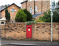
George VI postbox on Westbourne Grove, Scarborough
Image: © JThomas
Taken: 20 Feb 2016
0.04 miles
9
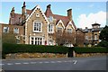
Moseley House, Westbourne Grove
Taken from the junction of Westbourne Road with Westbourne Grove, Moseley House is a detached house in a mid Victorian mixture of English Tudor and French Chateau styles. It was designed in 1868/9 by William Barry, a Scarborough architect. The distinctive yellow bricks probably came from the brickworks founded by John Barry, the father of William, off Seamer Road in the 1840s. The building on the right with Italianate tower is on Royal Crescent, see Image
Image: © Christopher Hall
Taken: 8 Apr 2014
0.04 miles
10
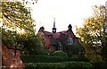
Former St Martins School
This is the former St Martin's C of E junior school on Royal Avenue. The school was opened in 1898 and designed by the Scarborough Architects Messrs Tugwell (Frank & Sydney Tugwell) in the Arts & Crafts style of which Frank Tugwell was a fine regional exponent.
The photograph was taken in October 1988 just before the demolition of the school.
Image: © Christopher Hall
Taken: Unknown
0.04 miles