IMAGES TAKEN NEAR TO
Lesley Avenue, YORK, YO10 4JR
Introduction
This page details the photographs taken nearby to Lesley Avenue, YO10 4JR by members of the Geograph project.
The Geograph project started in 2005 with the aim of publishing, organising and preserving representative images for every square kilometre of Great Britain, Ireland and the Isle of Man.

There are currently over 7.5m images from over14,400 individuals and you can help contribute to the project by visiting https://www.geograph.org.uk
Image Map
Images are licensed for reuse under creativecommons.org/licenses/by-sa/2.0
Notes
- Clicking on the map will re-center to the selected point.
- The higher the marker number, the further away the image location is from the centre of the postcode.
Image Listing (50 Images Found)
Images are licensed for reuse under creativecommons.org/licenses/by-sa/2.0
Image
Details
Distance
3
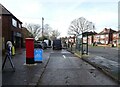
Service road off Broadway
Showing position of Postbox No. YO10 425.
See Image] for postbox.
Image: © JThomas
Taken: 23 Feb 2024
0.09 miles
4
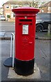
Elizabeth II postbox on Broadway
Image: © JThomas
Taken: 23 Feb 2024
0.09 miles
5
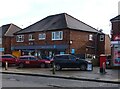
Fulford's Co-op on Broadway
Showing position of Postbox No. YO10 425.
See Image] for postbox.
Image: © JThomas
Taken: 23 Feb 2024
0.09 miles
6
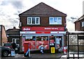
Broadway Post Office
Showing position of Postbox No. YO10 425.
See Image] for postbox.
Image: © JThomas
Taken: 23 Feb 2024
0.09 miles
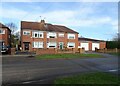
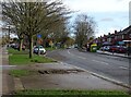
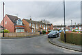
8
Danum Road
Looking along Danum Road near Welwyn Drive.
Image: © DS Pugh
Taken: 17 Dec 2020
0.10 miles
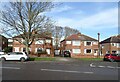
9
Moorland Road
Road off Fulford Road, the westernmost section of which is marked in the 1909 25 inch map, with the rest (including the houses here, on a section which links the main length of the road with Derwent Road) not appearing until the 1970 1:10,000 map.
Image: © Ian Capper
Taken: 4 Feb 2023
0.10 miles
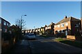
10
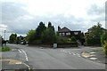
The Link
Looking across Danum Road onto Grants Avenue from The Link.
Image: © DS Pugh
Taken: 2 Aug 2021
0.10 miles