
IMAGES TAKEN NEAR TO
New Walk Terrace, YORK, YO10 4BG
Introduction
This page details the photographs taken nearby to New Walk Terrace, YO10 4BG by members of the Geograph project.
The Geograph project started in 2005 with the aim of publishing, organising and preserving representative images for every square kilometre of Great Britain, Ireland and the Isle of Man.

There are currently over 7.5m images from over14,400 individuals and you can help contribute to the project by visiting https://www.geograph.org.uk
Image Map
Images are licensed for reuse under creativecommons.org/licenses/by-sa/2.0
Notes
- Clicking on the map will re-center to the selected point.
- The higher the marker number, the further away the image location is from the centre of the postcode.
Image Listing (355 Images Found)
Images are licensed for reuse under creativecommons.org/licenses/by-sa/2.0
Image
Details
Distance
1
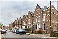
1 - 12 New Walk Terrace
Houses in New Walk Terrace built 1877-8, designed by the architect William Lewis and grade II listed - see https://historicengland.org.uk/listing/the-list/list-entry/1257056?section=official-list-entry. The houses have been nicknamed the "Twelve Apostles".
Image: © Ian Capper
Taken: 4 Feb 2023
0.00 miles
2
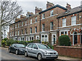
26 - 31 New Walk Terrace
Houses in New Walk Terrace, with the main terrace built c.1860.
Image: © Ian Capper
Taken: 4 Feb 2023
0.02 miles
3
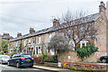
19 - 24 New Walk Terrace
Terrace built in 1876.
Image: © Ian Capper
Taken: 4 Feb 2023
0.02 miles
4

12a and 12b New Walk Terrace
End terrace houses in New Walk Terrace built c.1825. These two started off as two houses and were continuous with nos. 13 - 17 (the taller terrace beyond). However, soon after building they were combined into a single house (and shown as such on the 1852 1:500 Town Plan). From the late 19th to early 20th Century, the combined building was used as a school, Melbourne House. In the 1930s, by which time its role as a school had ceased, the place lost its top storey (apparently due to fire damage), and divided back into two houses, hence the nos. 12a and 12b.
Image: © Ian Capper
Taken: 4 Feb 2023
0.03 miles
5
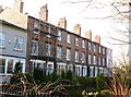
Regency terrace, New Walk Terrace
The south western corner of New Walk Terrace has a row of well proportioned terraced houses dating from the 1820's.
Image: © Gordon Hatton
Taken: 8 Feb 2009
0.03 miles
6
Victorian terrace, New Walk Terrace
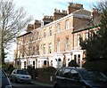
New Walk Terrace has some interesting terraced housing which appears to have developed from the riverside at New Walk back towards Fulford Road. These 3 storey houses date from the 1850's.
Image: © Gordon Hatton
Taken: 8 Feb 2009
0.03 miles
7
13 - 17 New Walk Terrace
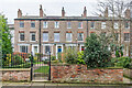
Terrace of houses in New Walk Terrace built c.1825. Grade II listed - see https://historicengland.org.uk/listing/the-list/list-entry/1257057?section=official-list-entry.
Image: © Ian Capper
Taken: 4 Feb 2023
0.03 miles
8
1 - 12 New Walk Terrace
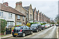
Houses in New Walk Terrace. The main terrace, nos 1 - 12, dates from 1877-8, designed by the architect William Lewis, and is grade II listed - see https://historicengland.org.uk/listing/the-list/list-entry/1257056?section=official-list-entry. The houses have been nicknamed the "Twelve Apostles". On the left are Glenton and Tyrone, a pair of c.1920s semi-detached houses first shown on the 1936 25 inch map, built in the grounds of the lodge to Fulford Grange.
Image: © Ian Capper
Taken: 4 Feb 2023
0.04 miles
9
New Walk, looking towards Fulford
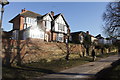
The house in the picture is appropriately called Water Gate, as usually when the river floods the Gate is also flooded !
For more details about New Walk see:
http://www.friendsofnewwalk.org.uk/history.php
Image: © Michael Jagger
Taken: 7 Mar 2010
0.04 miles
10
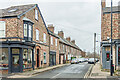
Sandringham Street
Late Victorian terraced housing, first shown on the 1891 1:500 Town Plan.
Image: © Ian Capper
Taken: 4 Feb 2023
0.04 miles