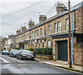
IMAGES TAKEN NEAR TO
Sandringham Street, YORK, YO10 4BA

Introduction

This page details the photographs taken nearby to Sandringham Street, YO10 4BA by members of the Geograph project.

The Geograph project started in 2005 with the aim of publishing, organising and preserving representative images for every square kilometre of Great Britain, Ireland and the Isle of Man.

There are currently over 7.5m images from over14,400 individuals and you can help contribute to the project by visiting https://www.geograph.org.uk

Image Map


Images are licensed for reuse under creativecommons.org/licenses/by-sa/2.0
Notes
  • Clicking on the map will re-center to the selected point.
  • The higher the marker number, the further away the image location is from the centre of the postcode.

Image Listing (413 Images Found)

Images are licensed for reuse under creativecommons.org/licenses/by-sa/2.0
  • ...
Image
Details
Distance
1
Sandringham Street
Late Victorian terraced housing, first shown on the 1891 1:500 Town Plan.
Image: © Ian Capper Taken: 4 Feb 2023
0.01 miles
2
Marlborough Grove
Late Victorian three-storeyed terraced housing, built around 1870, first shown on the 1891 1:500 Town Plan.
Image: © Ian Capper Taken: 4 Feb 2023
0.02 miles
3
Sandringham Street
Late Victorian terraced housing, first shown on the 1891 1:500 Town Plan.
Image: © Ian Capper Taken: 4 Feb 2023
0.02 miles
4
Marlborough Grove
Late Victorian three-storeyed terraced housing, built around 1870, first shown on the 1891 1:500 Town Plan.
Image: © Ian Capper Taken: 4 Feb 2023
0.02 miles
5
Victorian terrace, New Walk Terrace
New Walk Terrace has some interesting terraced housing which appears to have developed from the riverside at New Walk back towards Fulford Road. These 3 storey houses date from the 1850's.
Image: © Gordon Hatton Taken: 8 Feb 2009
0.03 miles
6
98 - 112 Fishergate
Row of shops on Fishergate, first marked (as houses, with individual front plots) on the 1891 1:500 Town Plan.
Image: © Ian Capper Taken: 4 Feb 2023
0.03 miles
7
98 - 112 Fishergate
Row of shops on Fishergate, first marked (as houses, with individual front plots) on the 1891 1:500 Town Plan.
Image: © Ian Capper Taken: 4 Feb 2023
0.03 miles
8
98 - 112 Fishergate
Row of shops on Fishergate, first marked (as houses, with individual front plots) on the 1891 1:500 Town Plan.
Image: © Ian Capper Taken: 5 Feb 2023
0.03 miles
9
19 - 24 New Walk Terrace
Terrace built in 1876.
Image: © Ian Capper Taken: 4 Feb 2023
0.03 miles
10
26 - 31 New Walk Terrace
Houses in New Walk Terrace, with the main terrace built c.1860.
Image: © Ian Capper Taken: 4 Feb 2023
0.04 miles
  • ...