
IMAGES TAKEN NEAR TO
James Street Caravan Site, James Street, YORK, YO10 3DT
Introduction
This page details the photographs taken nearby to James Street Caravan Site, James Street, YO10 3DT by members of the Geograph project.
The Geograph project started in 2005 with the aim of publishing, organising and preserving representative images for every square kilometre of Great Britain, Ireland and the Isle of Man.

There are currently over 7.5m images from over14,400 individuals and you can help contribute to the project by visiting https://www.geograph.org.uk
Image Map
Images are licensed for reuse under creativecommons.org/licenses/by-sa/2.0
Notes
- Clicking on the map will re-center to the selected point.
- The higher the marker number, the further away the image location is from the centre of the postcode.
Image Listing (172 Images Found)
Images are licensed for reuse under creativecommons.org/licenses/by-sa/2.0
Image
Details
Distance
1
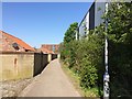
York Layerthorpe railway station (site)
Opened in 1912 by the Derwent Valley Light Railway, this station closed to passengers in 1926 and completely in 1987.
View north west along the former trackbed towards the junction with the freight-only Foss Island branch. The station building was just beyond the end of the large grey building on the right. The whole area has been redeveloped and no trace remains, except for this public footpath following the course of the line.
Image: © Nigel Thompson
Taken: 9 May 2016
0.02 miles
2
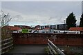
James Street Traveller Site
The cycle path connects from James Street to the Foss Islands path.
Image: © DS Pugh
Taken: 1 Jan 2025
0.02 miles
3
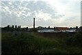
Sunset at Foss Islands
Looking across part of the travellers' site with the Destructor chimney in the distance.
Image: © DS Pugh
Taken: 6 Sep 2021
0.03 miles
4

Cycle path on James Street
Looking along the cycle path along the eastern side of James Street.
Image: © DS Pugh
Taken: 7 Mar 2021
0.03 miles
5
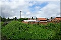
Tang Hall Beck near James Street
On the right is part of the James Street Traveller Site.
Image: © DS Pugh
Taken: 27 May 2024
0.03 miles
6
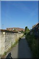
Cycle path near James Street
The cycle path from Osbaldwick approaching James Street.
Image: © DS Pugh
Taken: 18 Sep 2021
0.03 miles
7
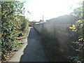
Boundary wall, James Street traveller site
The route of the dismantled Derwent Valley Light Railway, this is also the national cycle network's route 66. The sign on the wall reads 'Anyone caught tipping will be sorry'.
Image: © Christine Johnstone
Taken: 22 Oct 2022
0.03 miles
8
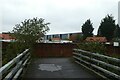
Bridge over Tang Hall Beck
Looking towards the James Street Traveller Site.
Image: © DS Pugh
Taken: 27 Oct 2022
0.04 miles
9
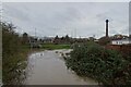
Flooded Tang Hall Beck
Looking towards James Street along the swollen stream.
Image: © DS Pugh
Taken: 1 Jan 2025
0.04 miles
10
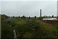
Tang Hall Beck
Looking towards James Street.
Image: © DS Pugh
Taken: 27 Oct 2022
0.04 miles