IMAGES TAKEN NEAR TO
Canford Crescent, WOLVERHAMPTON, WV8 2AF
Introduction
This page details the photographs taken nearby to Canford Crescent, WV8 2AF by members of the Geograph project.
The Geograph project started in 2005 with the aim of publishing, organising and preserving representative images for every square kilometre of Great Britain, Ireland and the Isle of Man.

There are currently over 7.5m images from over14,400 individuals and you can help contribute to the project by visiting https://www.geograph.org.uk
Image Map
Images are licensed for reuse under creativecommons.org/licenses/by-sa/2.0
Notes
- Clicking on the map will re-center to the selected point.
- The higher the marker number, the further away the image location is from the centre of the postcode.
Image Listing (40 Images Found)
Images are licensed for reuse under creativecommons.org/licenses/by-sa/2.0
Image
Details
Distance
4
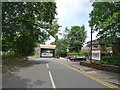
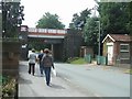
Station Bridge
The view near Codsall Railway Station in Staffordshire.
Image: © Gordon Griffiths
Taken: 22 Jul 2021
0.10 miles
5
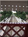
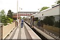
Station platforms from the repaired footbridge
The footbridge has recently been reinstated following restoration.
Image: © John M
Taken: 4 Aug 2007
0.10 miles
6
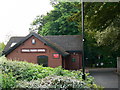
Codsall Parish Council offices, Station Road, Codsall, Staffordshire
Compact and unassuming, these offices doubtless perform a valuable community service.
Image: © Brian Robert Marshall
Taken: 25 May 2007
0.10 miles
7
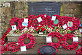
Codsall War Memorial
The memorial is part of a garden of remembrance on Station Road. The plaque was originally unveiled in 1925 and now reads: 'IN HONOUR AND GRATEFUL MEMORY OF THE MEN OF CODSALL PARISH WHO FOUGHT AND DIED IN THE GREAT WAR 1914 - 1918 AND IN THE 1939-1945 WORLD WAR'.
Image: © Stephen McKay
Taken: 16 Jan 2018
0.10 miles
8
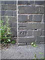
OS benchmark - Codsall, Station Road railway bridge
An OS cutmark on the bridge abutment; originally levelled in 1961 at 114.12m above Ordnance Datum Newlyn.
Image: © Richard Law
Taken: 9 Aug 2016
0.10 miles