IMAGES TAKEN NEAR TO
Cross Road, WOLVERHAMPTON, WV7 3RB
Introduction
This page details the photographs taken nearby to Cross Road, WV7 3RB by members of the Geograph project.
The Geograph project started in 2005 with the aim of publishing, organising and preserving representative images for every square kilometre of Great Britain, Ireland and the Isle of Man.

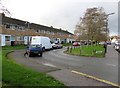
There are currently over 7.5m images from over14,400 individuals and you can help contribute to the project by visiting https://www.geograph.org.uk
Image Map
Images are licensed for reuse under creativecommons.org/licenses/by-sa/2.0
Notes
- Clicking on the map will re-center to the selected point.
- The higher the marker number, the further away the image location is from the centre of the postcode.
Image Listing (98 Images Found)
Images are licensed for reuse under creativecommons.org/licenses/by-sa/2.0
Image
Details
Distance
1
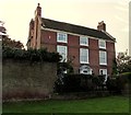
3-storey house on an Albrighton corner
High Street side of the house on the corner of Cross Road.
Image: © Jaggery
Taken: 1 Dec 2015
0.09 miles
2
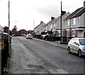
Lyncroft, Albrighton
Looking SSW along Lyncroft from the corner of High Street.
Image: © Jaggery
Taken: 1 Dec 2015
0.10 miles
3
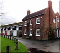
Manor Cottage, High Street, Albrighton
On the west side of housing and lockup garages in Wolverley Court. http://www.geograph.org.uk/photo/4756335
Image: © Jaggery
Taken: 1 Dec 2015
0.10 miles
4
Kill Your Speed, Albrighton
On a lamppost on the corner of High Street and Cross Road (ahead).
Image: © Jaggery
Taken: 1 Dec 2015
0.10 miles
5
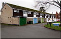
Wolverley Court, Albrighton
Housing with lock-up garages viewed from High Street.
Image: © Jaggery
Taken: 1 Dec 2015
0.10 miles
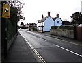
6
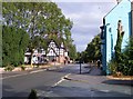
High Street View
The view in Albrighton, Shropshire.
Image: © Gordon Griffiths
Taken: 28 Jul 2018
0.10 miles
7
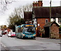
Wolverhampton bus in Albrighton
The Arriva single-decker on route 8 to Wolverhampton is at a High Street bus stop.
Image: © Jaggery
Taken: 1 Dec 2015
0.10 miles
8
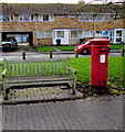
Queen Elizabeth II pillarbox and a bench in High Street, Albrighton
Ashfield houses are in the background.
Image: © Jaggery
Taken: 1 Dec 2015
0.10 miles
9
Ashfields, Albrighton
Ashfields is a 60 metre long row of houses parallel with High Street on the right.
Image: © Jaggery
Taken: 1 Dec 2015
0.11 miles
10
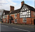
The Crown, Albrighton
High Street side of a pub extending around the corner ahead into Station Road.
Built as a house in the 16th century, remodelled in the early 18th century
with various later additions and alterations. Grade II listed in 1984.
Image: © Jaggery
Taken: 1 Dec 2015
0.11 miles