IMAGES TAKEN NEAR TO
Aldersley Road, WOLVERHAMPTON, WV6 9LT
Introduction
This page details the photographs taken nearby to Aldersley Road, WV6 9LT by members of the Geograph project.
The Geograph project started in 2005 with the aim of publishing, organising and preserving representative images for every square kilometre of Great Britain, Ireland and the Isle of Man.

There are currently over 7.5m images from over14,400 individuals and you can help contribute to the project by visiting https://www.geograph.org.uk
Image Map
Images are licensed for reuse under creativecommons.org/licenses/by-sa/2.0
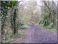
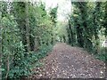
Notes
- Clicking on the map will re-center to the selected point.
- The higher the marker number, the further away the image location is from the centre of the postcode.
Image Listing (115 Images Found)
Images are licensed for reuse under creativecommons.org/licenses/by-sa/2.0
Image
Details
Distance
1
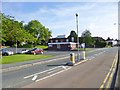
Tettenhall, health centre
Lower Green Health Centre, on Aldersley Road: http://www.tettenhallmedicalpractice.nhs.uk/contact-us-3/
Image: © Mike Faherty
Taken: 30 Jun 2013
0.04 miles
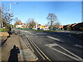
2
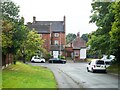
Junction of Grotto Lane and Lower Street
Image: © ElfExplorer
Taken: 3 Sep 2024
0.06 miles
4
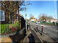
Lower Street View
The view near Lower Green Tettenhall, Wolverhampton.
Image: © Gordon Griffiths
Taken: 20 Jan 2022
0.07 miles
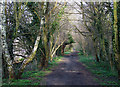
5
Bridge View
The view along the railway path in Claregate, Wolverhampton. The bridge is over the Smestow Brook.
Image: © Gordon Griffiths
Taken: 21 Feb 2018
0.07 miles
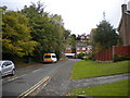
6
Lower Street Island
The view by Lower Green Tettenhall, Wolverhampton.
Image: © Gordon Griffiths
Taken: 20 Jan 2022
0.08 miles
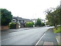
7
Grotto Lane, Tettenhall
Seen from Lower Street.
Image: © Richard Vince
Taken: 30 Sep 2017
0.08 miles
8
Course of old Railway, near Claregate, Wolverhampton
The Great Western Railway opened a branch line from Wolverhampton to Stourbridge via Wombourne in 1925. Seven years later it was closed to passengers, though freight ran into the 1960s. Here, looking towards Wolverhampton,it is now used as a leisure walk, connecting with Smestow Valley Nature Reserve, and the South Staffordshire Railway walk towards Kingswinford.
Image: © Roger D Kidd
Taken: 8 Feb 2008
0.08 miles
9
Autumn Railway
The view along the railway path in Tettenhall, Wolverhampton.
Image: © Gordon Griffiths
Taken: 27 Oct 2021
0.08 miles
10
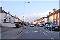
Aldersley Road
The view along Aldersley Road in Claregate, Wolverhampton.
Image: © Gordon Griffiths
Taken: 14 Apr 2018
0.09 miles