IMAGES TAKEN NEAR TO
Church Hill Road, WOLVERHAMPTON, WV6 9AT
Introduction
This page details the photographs taken nearby to Church Hill Road, WV6 9AT by members of the Geograph project.
The Geograph project started in 2005 with the aim of publishing, organising and preserving representative images for every square kilometre of Great Britain, Ireland and the Isle of Man.

There are currently over 7.5m images from over14,400 individuals and you can help contribute to the project by visiting https://www.geograph.org.uk
Image Map
Images are licensed for reuse under creativecommons.org/licenses/by-sa/2.0
Notes
- Clicking on the map will re-center to the selected point.
- The higher the marker number, the further away the image location is from the centre of the postcode.
Image Listing (120 Images Found)
Images are licensed for reuse under creativecommons.org/licenses/by-sa/2.0
Image
Details
Distance
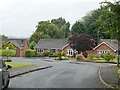
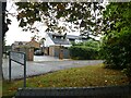
1
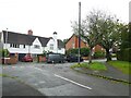
Junction of Lloyd Road and Church Hill Road
Image: © ElfExplorer
Taken: 3 Sep 2024
0.02 miles
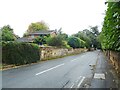
4
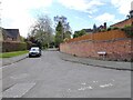
Lloyd Road
The view from Church Hill Road in Tettenhall, Wolverhampton.
Image: © Gordon Griffiths
Taken: 6 May 2021
0.04 miles
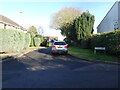
5
Clifton Road
The view from Church Hill Road Tettenhall, Wolverhampton.
Image: © Gordon Griffiths
Taken: 20 Jan 2022
0.05 miles
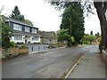
6
Bowood Drive
The view from Church Hill Road Tettenhall, Wolverhampton.
Image: © Gordon Griffiths
Taken: 20 Jan 2022
0.05 miles
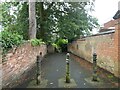
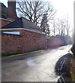
8
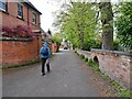
Church Hill Road
The view in Tettenhall of the lane from St Michael and All Angels Churchyard.
Image: © Gordon Griffiths
Taken: 6 May 2021
0.07 miles