IMAGES TAKEN NEAR TO
Nethy Drive, WOLVERHAMPTON, WV6 8TF
Introduction
This page details the photographs taken nearby to Nethy Drive, WV6 8TF by members of the Geograph project.
The Geograph project started in 2005 with the aim of publishing, organising and preserving representative images for every square kilometre of Great Britain, Ireland and the Isle of Man.

There are currently over 7.5m images from over14,400 individuals and you can help contribute to the project by visiting https://www.geograph.org.uk
Image Map
Images are licensed for reuse under creativecommons.org/licenses/by-sa/2.0
Notes
- Clicking on the map will re-center to the selected point.
- The higher the marker number, the further away the image location is from the centre of the postcode.
Image Listing (19 Images Found)
Images are licensed for reuse under creativecommons.org/licenses/by-sa/2.0
Image
Details
Distance
1
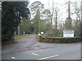
Government Offices - Woodthorne
This is one of the more anonymous governmental offices. The HQ of ADAS, Agric Advisory Service is hidden somewhere behind the trees. These offices have had numerous names and titles over the years Ministry of Agriculture, Fisheries and Food (MAFF) and now DEFRA.
Image: © John M
Taken: 30 Dec 2006
0.09 miles
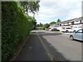
7
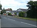
Junction of Redhouse Road and Hinckes Road
Image: © ElfExplorer
Taken: 3 Aug 2024
0.21 miles